


Scattered snow showers, gusty winds, and cold temperatures this evening across the Tri-State.
Blowing snow, wet roads, and low visibility may briefly impact travel. Be prepared for sudden changes in visibility and watch for possible slick spots overnight. Snow accumulation should remain light for most areas.
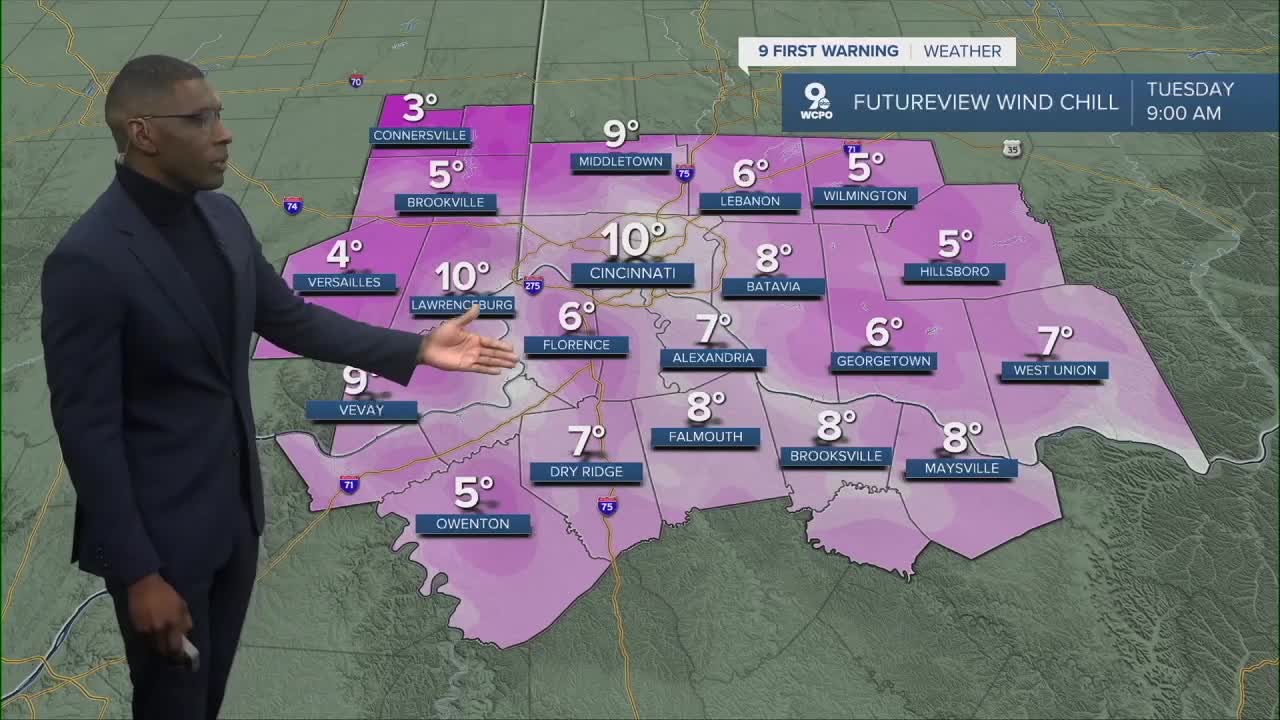
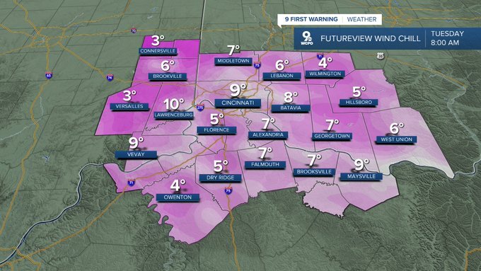
Spring weather is on pause as temperatures become sharply colder. Plan on dressing in layers on Tuesday due to the bitter cold. Expect wind chill values in the single-digits Tuesday morning.
It'll be a very cold St. Patrick’s Day from start to finish as highs will only reach the low 30s and wind chills in the 20s due to gusty winds.
Another chance for isolated snow showers returns Wednesday morning. After that, a warming trend begins as highs climb back into the 40s.

Spring gets back in motion later this week. Highs will return to near 60 on Thursday and rise into the middle 60s by Friday. The warm up continues into the weekend with a high near 70 and dry conditions on Saturday. No rain or snow is expected this weekend.
MONDAY NIGHT
Mostly cloudy
Wind chill near 9º
Low: 18
TUESDAY
Mostly cloudy
Chilly
High: 31
TUESDAY NIGHT
Mostly cloudy
Very cold
Low: 22
9 First Warning Weather 24/7 Livestream
==========
- Interactive Radar: Track weather to your doorstep
- Sign up for severe weather email alerts
- Check latest school closings and delays
- WCPO traffic updates
- Metro bus detours and updates (or call the hotline at 513-632-7538)
- Latest power outages from Duke Energy
- Flight cancellations and delays from CVG, other U.S. airports
