

We are kicking off day 3 of our heat wave. It's also another 9 First Warning Weather Alert Day as the heat continues to dominate the forecast and take a toll on our bodies.
An extreme heat warning is in effect until Thursday evening.

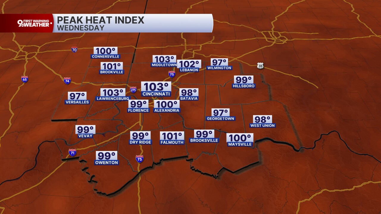
Temperatures start in the mid to upper 70s this morning with hazy and muggy conditions. We'll warm to 90 degrees by noon and then continue climbing to 95 degrees by 3 p.m. Today and Thursday should be the two hottest days of the week as the high pressure ridge sets up shop right over us. The heat index today will rise to 105. Officially on Tuesday, the heat index hit 103, so today is even a little bit higher. The sky will be mostly sunny and the forecast is still dry.
Thursday's forecast is the same! High of 95 degrees with a heat index of 105 degrees and mostly sunny.
Friday will finally bring a small rain chance back into the Tri-State forecast. It's only a 30% chance, but we should see some pop-up pulse storms in the peak heat of the afternoon. The high still rises to 93 with a heat index of 102 degrees. The NWS may issue a heat advisory for Friday.
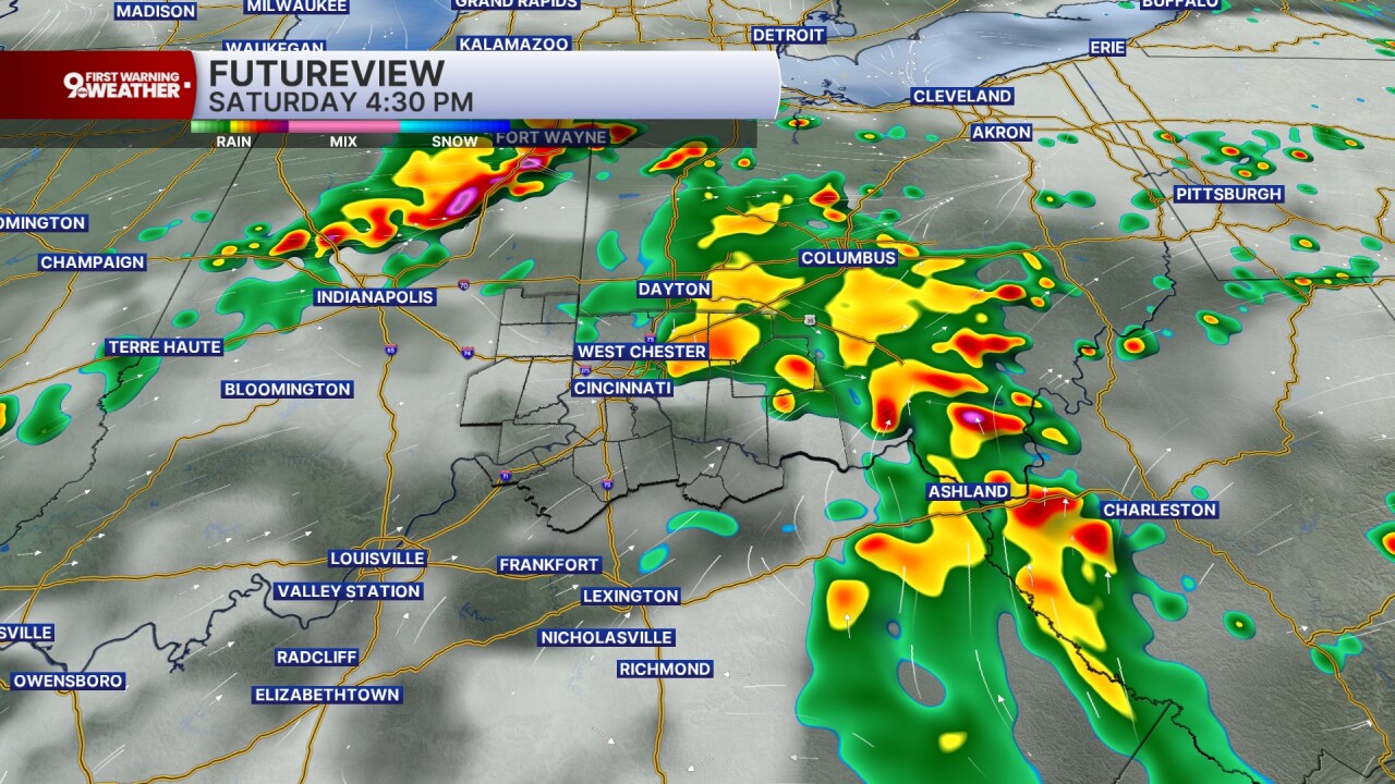
Saturday is the 4th of July and it's still going to be hot! The high should be around 92 degrees with a heat index closer to 100-102 degrees. The sky will be partly cloudy and we'll see scattered thunderstorms in the afternoon hours. Isolated showers also linger into the evening hours. We'll get a better look at storm placement and timing over the next 24-48 hours, so check back in on the forecast as we'll have some updates for you!

MORNING RUSH
Warm and muggy
Hazy
Low: 78
WEDNESDAY
Hot and humid
Feels like 105 degrees
High: 95
WEDNESDAY NIGHT
Very humid
Few clouds
Low: 75
THURSDAY
Mostly sunny
Hot, humid and hazy
High: 95
THURSDAY NIGHT
Few clouds
Still very muggy
Low: 75
9 First Warning Weather 24/7 Livestream
==========
- Interactive Radar: Track weather to your doorstep
- Sign up for severe weather email alerts
- Check latest school closings and delays
- WCPO traffic updates
- Metro bus detours and updates (or call the hotline at 513-632-7538)
- Latest power outages from Duke Energy
- Flight cancellations and delays from CVG, other U.S. airports
