


The weather across the area will stay fairly quiet and mild for early March. This is after an incredibly warm day with a high of 78, which breaks the old record of 74 set in 2023. Overnight, skies will be partly cloudy with temperatures gradually cooling into the lower to mid-60s by daybreak.
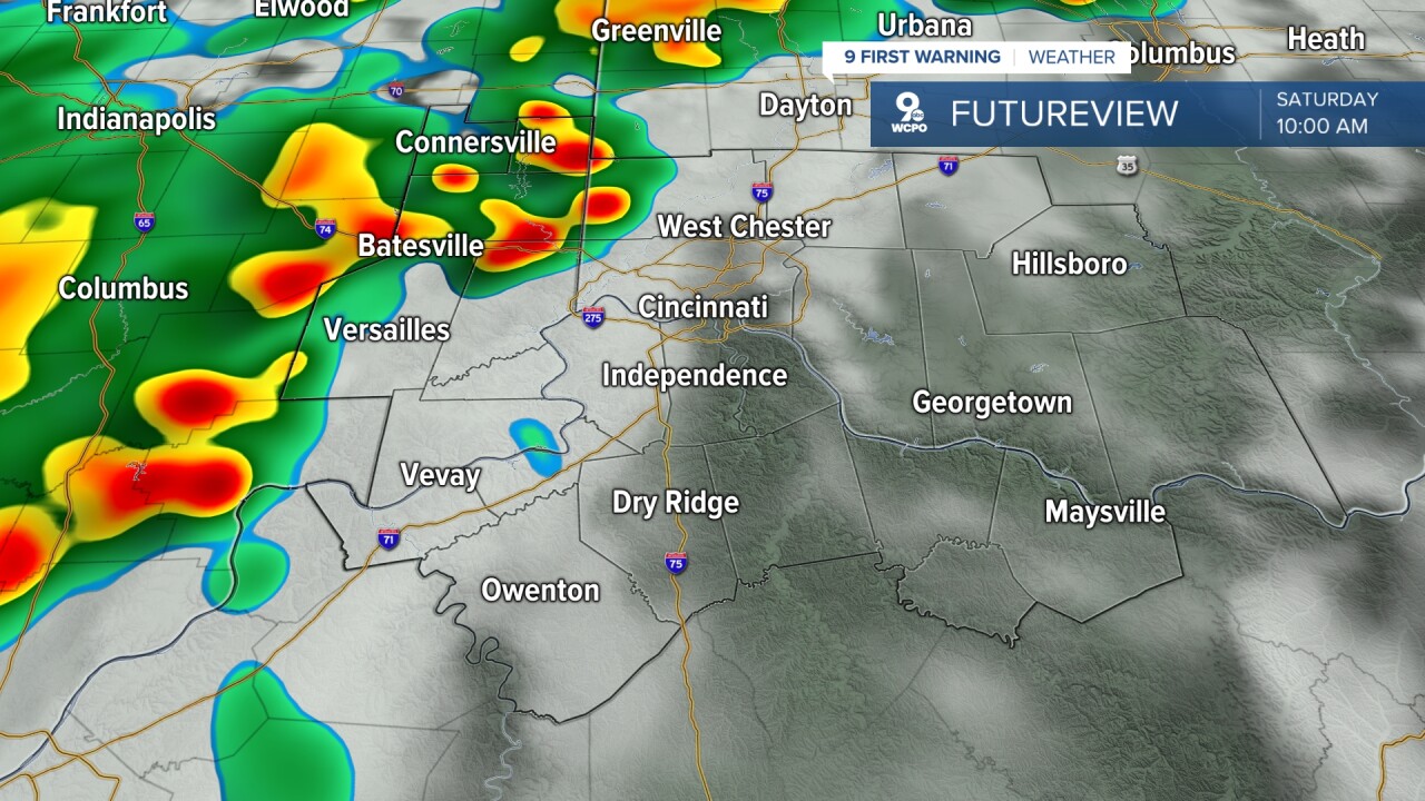
As we head into Saturday, attention turns to a developing weather system moving through the Ohio Valley. Saturday will begin mostly cloudy and warm with temperatures climbing toward the upper 60s or near 70 degrees and a chance for a spotty shower.
During the afternoon and evening, scattered showers and thunderstorms will develop as the system approaches. Some storms could become stronger, especially later in the day, with gusty winds and brief heavy rain being the main concerns. Any thunderstorm could produce brief heavy downpours and lightning. Because of that, it will be important to monitor changing conditions through Saturday evening.
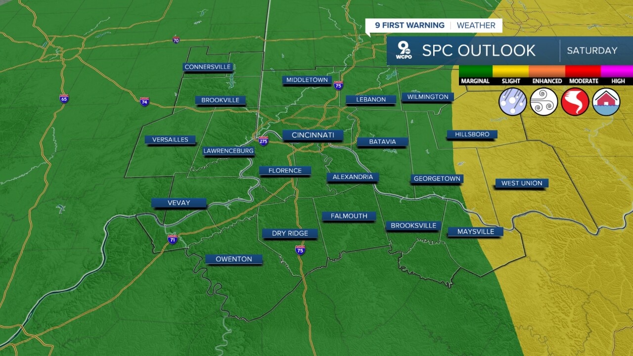
The Storm Prediction Center indicates the potential for a few stronger storms in parts of the Ohio Valley during this time, although the overall severe threat appears somewhat limited, as we have only a "Marginal Risk-category one out of five.
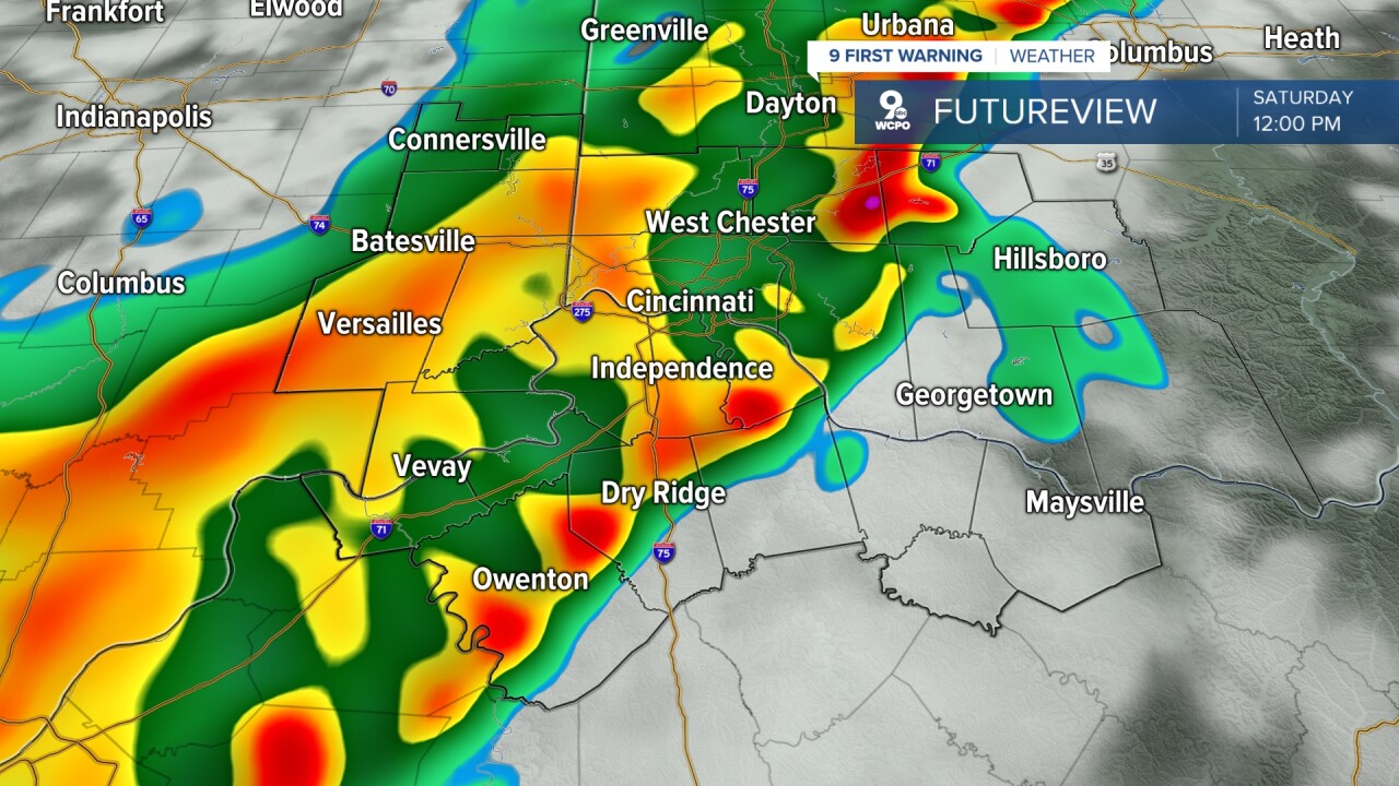
Another concern this weekend will be rainfall totals. The Weather Prediction Center notes that repeated showers and thunderstorms could lead to pockets of heavier rain. While widespread river flooding is not expected right now, localized flooding could still occur in low-lying areas, places with poor drainage, or near small creeks if heavier rain falls in a short period of time. Ponding on roads could also happen during heavier downpours.
By Sunday, the system begins moving away from the region. Skies should gradually improve with a mix of clouds and some sunshine returning by afternoon. Temperatures will remain mild with highs in the 60s. Sunday is also the start of Daylight Saving Time as we spring forward!
TONIGHT
Parlty cloudy
Mild
Low: 63
SATURDAY
Showers and storms
A few strong to severe storms
High: 71
SATURDAY NIGHT
Few clouds
Chance showers
Low: 45
SUNDAY
Partly cloudy
Pleasant, mild
High: 63
9 First Warning Weather 24/7 Livestream
==========
- Interactive Radar: Track weather to your doorstep
- Sign up for severe weather email alerts
- Check latest school closings and delays
- WCPO traffic updates
- Metro bus detours and updates (or call the hotline at 513-632-7538)
- Latest power outages from Duke Energy
- Flight cancellations and delays from CVG, other U.S. airports
