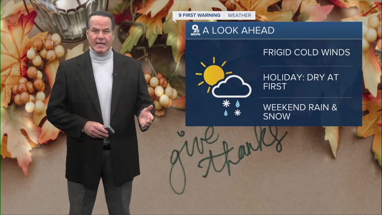


We will have mostly cloudy skies heading to Thanksgiving morning and gusty winds, and it's going to get bitterly cold. Overnight lows will drop to the mid to upper 20s, but feel like the teens in the morning.

Thanksgiving brings the sunshine back, but the cold is here to stay. Highs will only reach the upper 30s, and the holiday morning will start in the upper 20s, yet feeling like the teens. Anyone running in the Thanksgiving Day race will want to bundle up, because it will be a cold start with a biting wind.
Friday stays chilly despite plenty of sun. Highs will sit in the mid-30s, and although the wind won’t be quite as strong, it will still feel brisk, with some areas seeing wind chills in the single digits.
The outlook for the weekend remains complicated as we track an area of low pressure moving toward the region. In the last day, forecast models have bounced between snow on Saturday and rain on Sunday.

The onset of moisture Saturday morning, coupled with below freezing temperatures, likely will spell snow, then transitioning to a rain/snow mix and eventually rain Saturday afternoon and evening. As always, conditions could change, so it’s a good idea to stay weather aware through the weekend as the forecast becomes clearer.
TONIGHT
Mostly cloudy
Windy
Low: 27
THANKSGIVING
Mix clouds & sunshine
Windy
High: 38
THURSDAY NIGHT
Mostly clear
Light wind
Low: 21
FRIDAY
Mostly sunny
Cold
Highs: 34
9 First Warning Weather 24/7 Livestream
==========
- Interactive Radar: Track weather to your doorstep
- Sign up for severe weather email alerts
- Check latest school closings and delays
- WCPO traffic updates
- Metro bus detours and updates (or call the hotline at 513-632-7538)
- Latest power outages from Duke Energy
- Flight cancellations and delays from CVG, other U.S. airports
