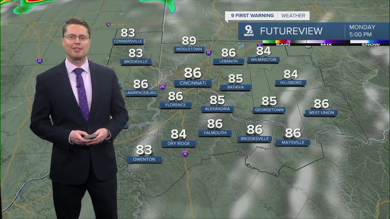


The warm and muggy weather will continue into the workweek! Monday starts in the upper 60s, and then we warm up into the mid 80s in the afternoon with more sunshine than clouds. There will be some extra wind around, making it feel a little more comfortable. Monday night, a few scattered showers could clip areas mainly northwest of Cincinnati.

Tuesday starts dry, but in the afternoon, scattered showers and storms start to pup up ahead of our next cold front. Assuming we stay dry long enough, we will warm into the mid 80s again. It will also be breezy.
Rain and storms will become more likely Tuesday night as the cold front gets closer to the Tri-State. From afternoon to night, we could see a few strong to severe storms mix in. The main concern will be areas of damaging wind, but a couple pockets of hail will also be possible.

Some leftover rain continues into Wednesday morning, and then the afternoon looks drier and cooler. Highs will be in the low 70s.
We continue to cool off behind the cold front Thursday with upper 60s in the afternoon. There's a small chance for some rain Thursday, but it's far from a guarantee right now.
Friday will be a touch warmer, and closer to average, with low 70s.
Another round of rain is possible Friday into Saturday. Even with a wet start to the weekend, we keep warming back up. Saturday will be in the mid 70s, followed by upper 70s on Sunday.
Then, its back to the low 80s early in the next workweek.
OVERNIGHT
Mostly clear
Mild
Low: 67
MONDAY
Partly cloudy
Breezy at times
High: 86
MONDAY NIGHT
Partly cloudy
Spotty rain northwest
Low: 69
TUESDAY
Mostly cloudy
Storms likely
Breezy
High: 84
9 First Warning Weather 24/7 Livestream
==========
- Interactive Radar: Track weather to your doorstep
- Sign up for severe weather email alerts
- Check latest school closings and delays
- WCPO traffic updates
- Metro bus detours and updates (or call the hotline at 513-632-7538)
- Latest power outages from Duke Energy
- Flight cancellations and delays from CVG, other U.S. airports
