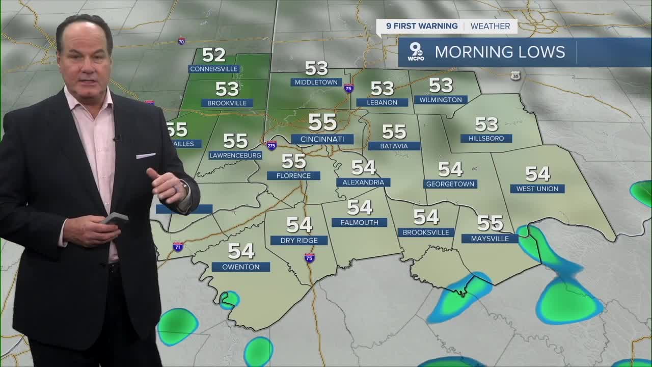


Clouds will hang around into the morning, across the area, with cool and calm conditions settling in as temperatures dip into the mid-50s.
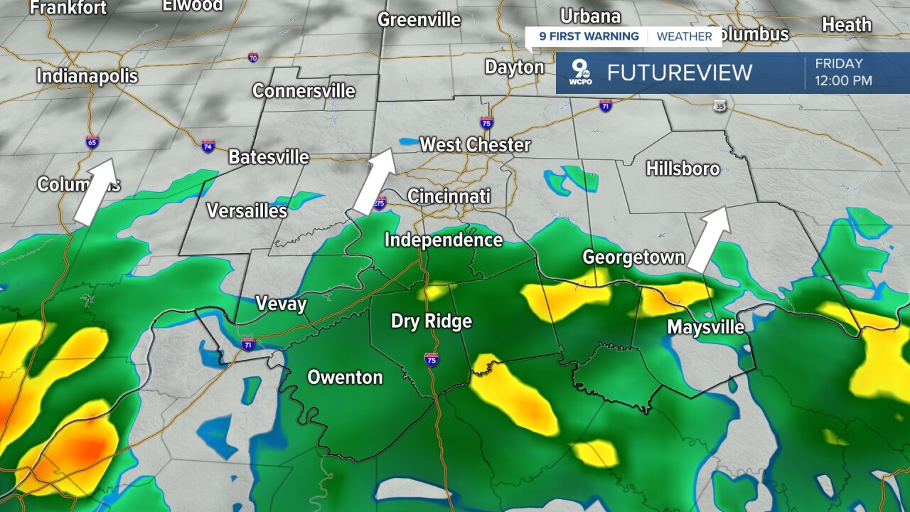
The weather pattern starts becoming much more active on Friday as a southwest flow pushes a disturbance into the Tri-State, helping showers spread into the region during the day before thunderstorms develop later in the afternoon and evening. A warm front lifting north near the Ohio River will help fuel additional rain and storms Friday night into Saturday as another wave of energy moves in.
I’m watching increasing moisture levels in the atmosphere, which could allow for periods of heavy rainfall, especially south and east of Interstate 71, where the potential for localized flooding appears highest. While instability looks somewhat limited overall, there may still be enough overlap of wind shear and instability late Friday into Friday evening for a few strong to, perhaps severe, storms to develop near and south of the warm front. Right now, the Storm Prediction Center has placed a portion of the Tri-State, mainly from the river south, in a “Marginal Risk”.

Showers and thunderstorms continue into Saturday, although the heavier rainfall threat should gradually shift east later in the day. Saturday night may finally bring a brief break with only isolated showers before scattered afternoon and evening storms return Sunday and continue into Memorial Day. Temperatures through the holiday weekend will trend warmer with muggy conditions developing, while periods of showers and thunderstorms remain part of the forecast right through Monday night.
TONIGHT
Clouding back up
Dry
Low: 55
FRIDAY
Showers and storms
Heavy rain at times
Flood issues possible in spots
High: 68
FRIDAY NIGHT
More rain and storms
Low: 63
9 First Warning Weather 24/7 Livestream
==========
- Interactive Radar: Track weather to your doorstep
- Sign up for severe weather email alerts
- Check latest school closings and delays
- WCPO traffic updates
- Metro bus detours and updates (or call the hotline at 513-632-7538)
- Latest power outages from Duke Energy
- Flight cancellations and delays from CVG, other U.S. airports
