


Clouds will start to move in overnight, but we stay dry into the Monday morning commute. There could be a few foggy areas as we drop down into the mid 30s.
The clouds will thicken up through Monday. At the earliest, a few spotty light showers could pop up in the afternoon, but a lot of the Tri-State has a good chance of being dry into the evening commute. Highs will be in the mid 50s.
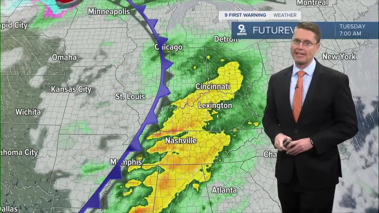
Ahead of our next cold front, scattered rain will become more common Monday night and into the Tuesday morning commute. As some last-minute warmer air blows in ahead of the cold front, we could make it close to 60 degrees, even as the rain continues into the afternoon.

A few leftover showers could still be around Wednesday morning, but the afternoon looks dry and mostly cloudy. Behind the cold front, it will be breezy as the colder air moves in. We could hit the low 50s Wednesday morning, but there will be enough colder air moving in to drop us into the 40s for the afternoon.
Thanksgiving will be dry, but it stays breezy with highs only in the upper 30s. At least there will be a lot of sunshine!

The wind lightens up Friday, but it stays chilly for your Black Friday shopping with upper 30s.
We start to warm back up next weekend. Saturday will be in the low 40s, but there's a small chance for rain by the end of the day. Rain will be more likely Sunday with upper 40s.
Some leftover rain could continue into early next week, but we should be dry enough at times to reach the low 50s.
OVERNIGHT
Partly cloudy
Foggy areas
Low: 35
MONDAY
Mostly cloudy
Spotty p.m. rain
High 56
MONDAY NIGHT
Cloudy
Rain likely
Low: 49
TUESDAY
Cloudy
Rain likely
High: 60
9 First Warning Weather 24/7 Livestream
==========
- Interactive Radar: Track weather to your doorstep
- Sign up for severe weather email alerts
- Check latest school closings and delays
- WCPO traffic updates
- Metro bus detours and updates (or call the hotline at 513-632-7538)
- Latest power outages from Duke Energy
- Flight cancellations and delays from CVG, other U.S. airports
