



It's going to be a cloudy, dreary day and thunderstorms will return, but not until later in the day.
Thursday morning starts with an overcast sky and temperatures in the mid 60s. We'll see a few sprinkles at times. The sky stays mostly cloudy to overcast today as temperatures warm to 76 degrees. This is still well above average for mid-October. A warm front is lifting north through the Ohio Valley today and this is bringing in the warmer air and eventually a chance of storms.
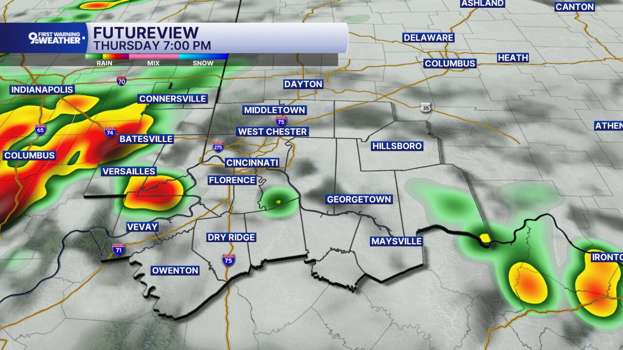
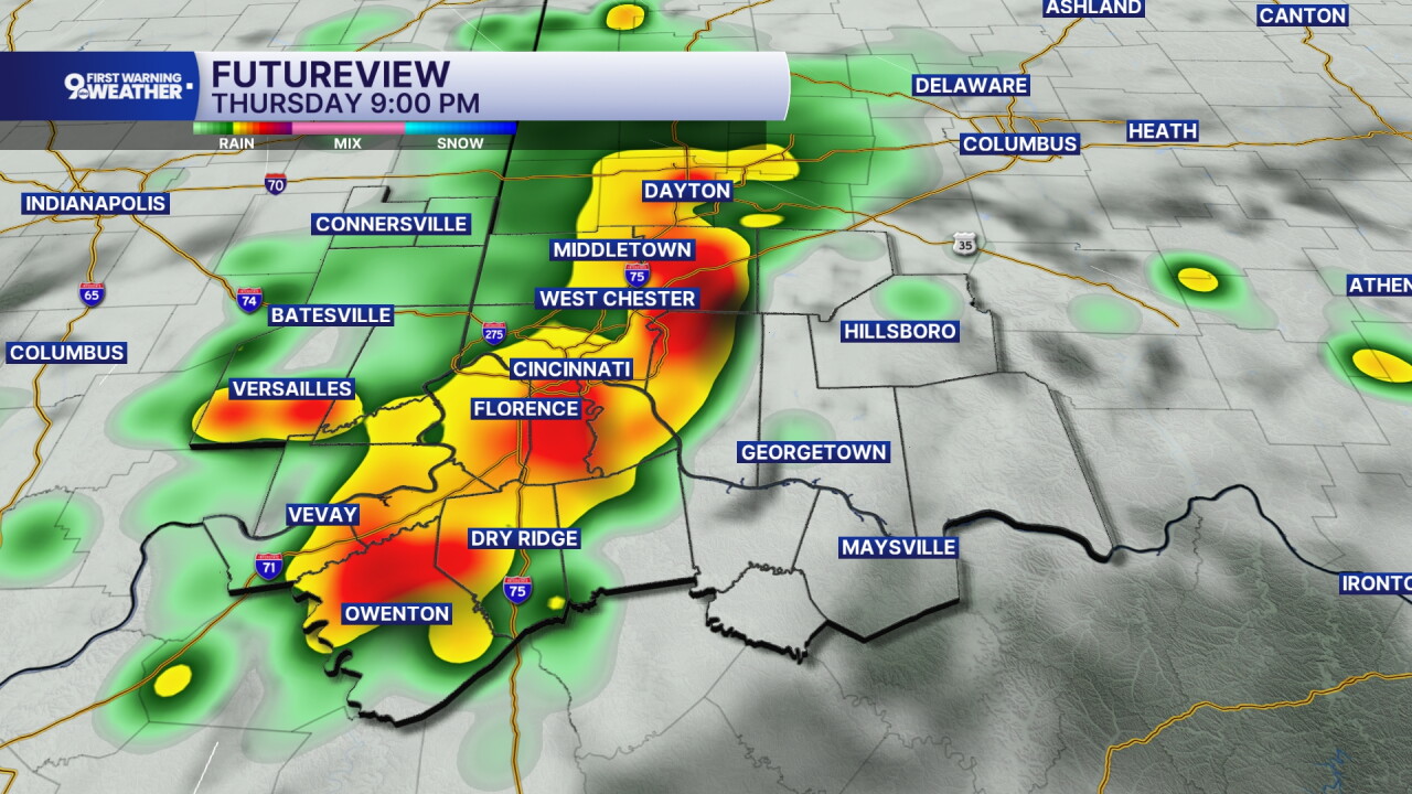
Spotty storms should develop later today, especially after 5 p.m. An isolated strong to severe storm is possible with damaging winds as the main concern if something were to turn severe. Storms are most likely from 5 to 10 p.m.
Clouds will decrease a bit tonight as temperatures cool to 65 on Friday morning. A cold front is passing as we start the day and this will result in a few things happening.
- More rain, spotty and light
- Falling temperatures
- Breezy winds
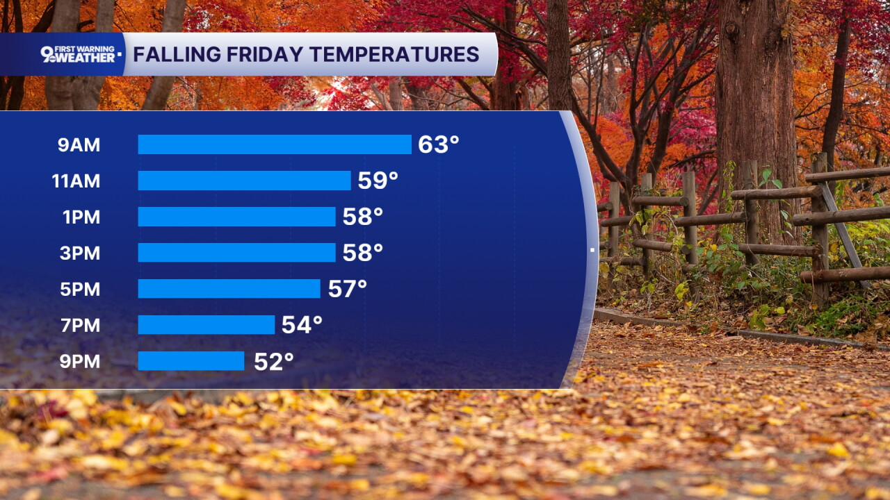
Friday's temperatures will fall throughout the day. We'll start at 65 and cool to the mid 50s by the evening drive. The sky will be overcast all day long and at times, we'll see scattered showers. Storms are not expected. It's also going to be windy throughout the day as winds come in from the northwest at 15 to 25 mph, gusting to 35 mph. While this isn't worthy of a wind advisory, it's something to consider if you are driving a larger profile vehicle or if you have a larger Halloween display. It might not be the best day to put up those inflatable decorations.
The weekend brings much colder air. We'll cool to 41 Saturday morning and only warm to 56 under a sunny sky. Frost is still expected Sunday morning as we drop to the mid 30s.
MORNING RUSH
Mostly cloudy
A few sprinkles
Low: 65
THURSDAY
Mostly cloudy
Evening storms
High: 76
THURSDAY NIGHT
Partly cloudy
Slight rain chance
Low: 64
FRIDAY
Mostly cloudy, falling temps
Light rain, windy
High: 65
FRIDAY NIGHT
Clearing sky
Much colder
Low: 41
9 First Warning Weather 24/7 Livestream
==========
- Interactive Radar: Track weather to your doorstep
- Sign up for severe weather email alerts
- Check latest school closings and delays
- WCPO traffic updates
- Metro bus detours and updates (or call the hotline at 513-632-7538)
- Latest power outages from Duke Energy
- Flight cancellations and delays from CVG, other U.S. airports
