


We saw a variety of weather across the Tri-State on Monday. Some neighborhoods had sun, others had rain, and still some spots had just clouds. It's more universal for our Tuesday as clouds continue before a few showers scatter across the Tri-State.

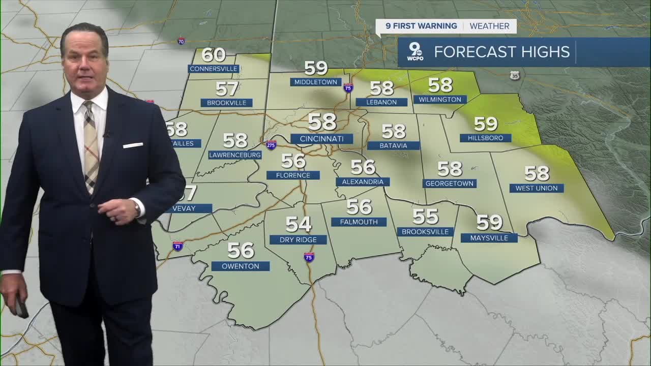
Tuesday Morning lows will drop to the upper 40s as most communities see simply clouds throughout the day. Afternoon highs reach into the upper 50s for most. But at night, rain will develop.
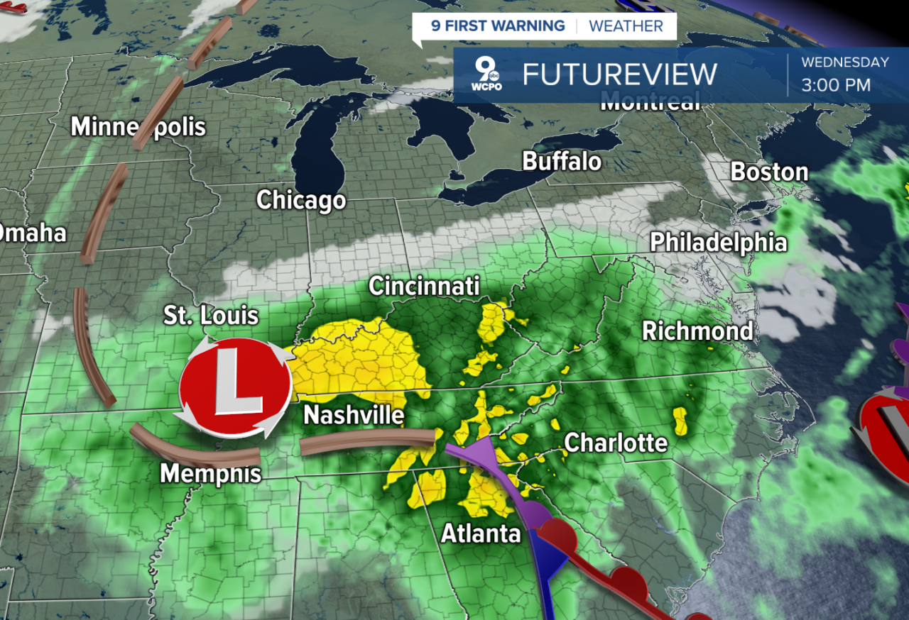
An area of low pressure will trigger rain starting near midnight, and the wet weather really kicks in on Wednesday. Wednesday will be an umbrella day as rain will increase into the evening hours and continue with leftover showers on Thursday.

In addition, the northwesterly winds, clouds, and rain will keep the afternoon temps chilly in the low 50s.
The good news here is the rainmaker heads out of the town by Halloween, leaving a good forecast for all the kiddos. As the weekend looks mostly dry right now.

OVERNIGHT
Isolated showers
Mostly cloudy
Low: 48
TUESDAY
Overcast
Isolated rain chance
High: 58
TUESDAY NIGHT
Spotty light showers
Overcast
Low: 45
9 First Warning Weather 24/7 Livestream
==========
- Interactive Radar: Track weather to your doorstep
- Sign up for severe weather email alerts
- Check latest school closings and delays
- WCPO traffic updates
- Metro bus detours and updates (or call the hotline at 513-632-7538)
- Latest power outages from Duke Energy
- Flight cancellations and delays from CVG, other U.S. airports
