


For our overnight, it’s mostly cloudy with temperatures very gradually dropping as lows will fall into the low 50s. Keep in mind, our average afternoon high is 44 degrees at this time of year. Winds stay fairly light but build a bit toward daybreak.
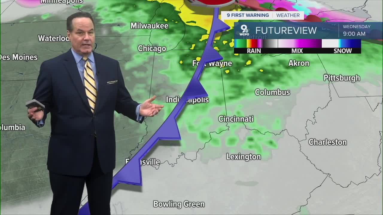
Wednesday will be breezy and mild for mid-February with spotty showers early in the day because of a front that will sweep in here early. Then, skies break for a mix of sun and clouds. Winds from the southwest could make it feel like spring is trying to work in early, with highs in the mid to upper 60s. Our record is 68 degrees from 1948. It’s a real possibility that we’ll tie or break it. Wednesday night temperatures slide back into the mid-40s.
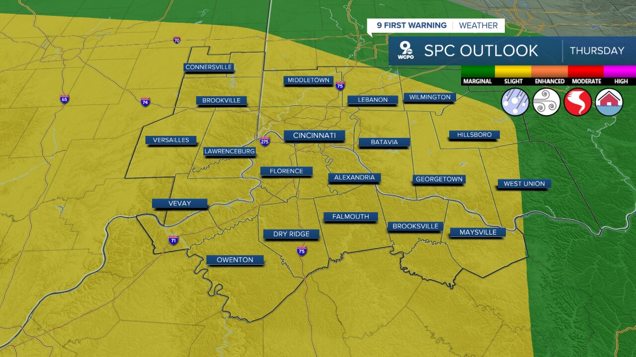
Thursday is a 9 FIRST WARNING WEATHER ALERT DAY.

This is a “fence-sitting” severe weather day. The severe parameters are around, but not all that strong. We are in a “SLIGHT RISK” for severe weather from the Storm Prediction Center. Showers and a chance for storms early will lead to heavy pockets of rain and stronger storms around dinner time into Thursday night. This is where damaging winds are possible, and while other threats are on the table, it doesn’t seem significant at the moment.
As the weekend approaches, the pattern shifts dramatically. Cooler air returns on Friday with mostly sunny but windy conditions and highs only in the low 50s, dropping down into the low 30s Friday night. Over Saturday and Sunday, colder air arrives in earnest, setting the stage for a chance for snow showers and temperatures well below freezing. This weekend will feel much more like classic winter than the spring-teasing warmth we have right now.
Cooler air will come back in behind this system. It's a slow cooldown, so we'll still have nice weather to enjoy on Friday as highs still make it into the mid 50s under a mostly cloudy sky. It will be a great Friday evening for the first fish fries of the Lenten season!
OVERNIGHT
Overcast
Spotty rain
Low: 52
WEDNESDAY
Mostly cloudy
Hit and miss a.m. rain
Windy
High: 67
WEDNESDAY NIGHT
Mostly cloudy
Cooler
Low: 46
9 First Warning Weather 24/7 Livestream
==========
- Interactive Radar: Track weather to your doorstep
- Sign up for severe weather email alerts
- Check latest school closings and delays
- WCPO traffic updates
- Metro bus detours and updates (or call the hotline at 513-632-7538)
- Latest power outages from Duke Energy
- Flight cancellations and delays from CVG, other U.S. airports
