


Heading into Monday morning, a few more scattered snow showers will move through the Tri-State. A lot of us won't see any snow stick to the ground, but a few cities could pick up a quick dusting. Watch for slick spots where any snow sticks.
As a reinforcing shot of arctic air moves in, Monday will be cold and windy! We start the day with a lot of clouds and temperatures in the teens. The afternoon brings more sunshine, but we will struggle to even hit the low 20s. The wind chill will likely be in the single digits all day.

The best place for you and your pets will be inside where its warm, but if anyone needs to be out for an extended period, make sure you dress in layers and cover us as much skin as possible to avoid frostbite.
As the kids head back to school Tuesday, they'll need extra layers! Temperatures will be in the single digits in the morning. Tuesday afternoon will be partly cloudy with mid 20s.
A warm front arrives Wednesday, allowing some slightly warmer weather to move into greater Cincinnati with some sunshine. Highs will be in the low 40s, getting us back to average and above freezing!
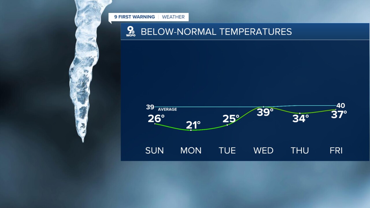
We start to cool back off late in the week. Thursday will be in the mid 30s followed by low 30s on Friday.
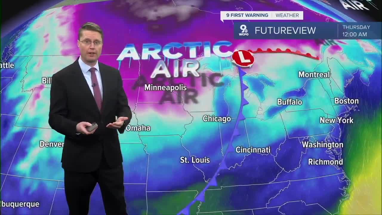
There's a lot of uncertainty with the next winter storm moving across the United States into the weekend. Right now, it looks like the bigger impacts will be in the Southeast, but we could get clipped by some lighter snow late Friday or Saturday.
At the same time, another shot of arctic air will move in from the north. Saturday will kick off another multi-day stretch of afternoon temperatures in the 20s which will go through at least early next week.
OVERNIGHT
Spotty snow
Cold
Low: 17
MONDAY
Clearing skies
Windy
High: 21
MONDAY NIGHT
Mostly clear
Frigid
High: 8
TUESDAY
Mostly sunny
Very cold
High: 25
9 First Warning Weather 24/7 Livestream
==========
- Interactive Radar: Track weather to your doorstep
- Sign up for severe weather email alerts
- Check latest school closings and delays
- WCPO traffic updates
- Metro bus detours and updates (or call the hotline at 513-632-7538)
- Latest power outages from Duke Energy
- Flight cancellations and delays from CVG, other U.S. airports
