


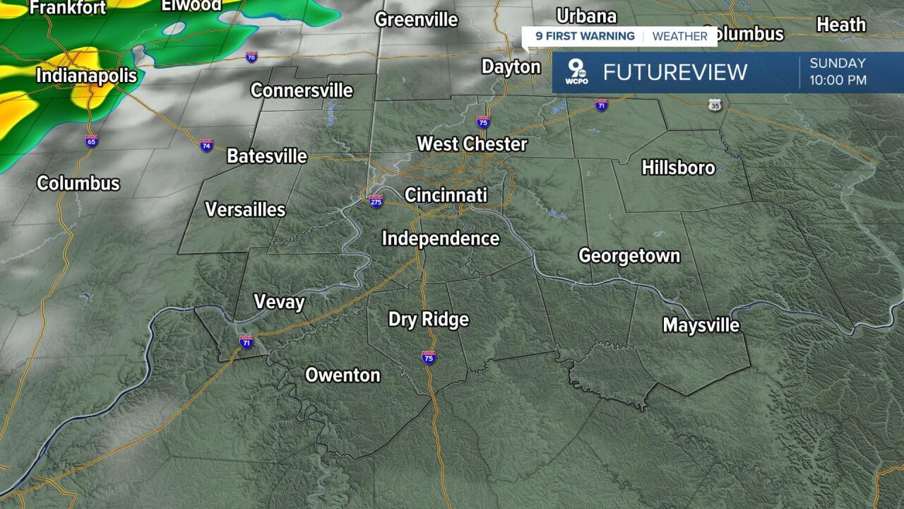
We have been stuck in a warm summer-like pattern the last seven days, but we will get a break from that soon.

That comes in the form of a cold front overnight tonight and into Monday morning. Unfortunately, that means we are in for potential rough weather during the early morning hours on Monday. All of the Tri-State has been placed in the Marginal Risk, level 1 of 5, for severe weather this evening and overnight tonight. Our two main impacts are damaging winds and large hail, but flooding may be an issue as well, especially after the heavy rain many areas picked up on Saturday. I would say the best areas for these threats are to the west of Cincinnati into southeast Indiana.
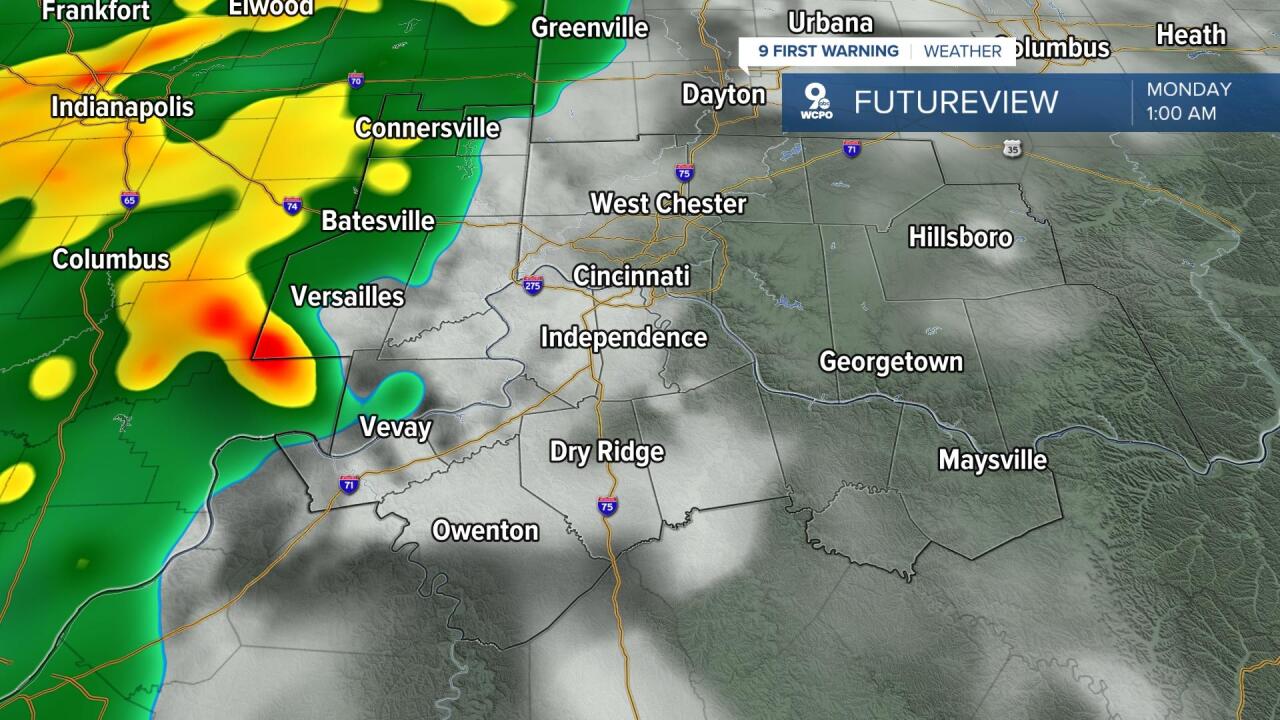
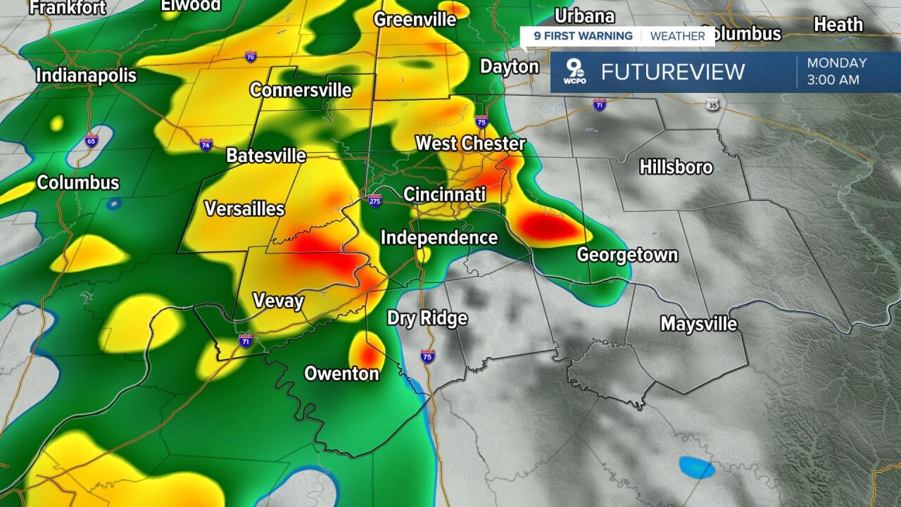
The latest timeline looks like storms will move in after 1 a.m. Monday morning, but they should be weakening as they roll through.
Unfortunately, these storms overnight will limit our chances of seeing the total Lunar Eclipse which is occurring tonight. It is already underway and while we can see it now, you won’t likely see it all night in the Tri-State, but you can still stream it! If you want more information, make sure to read my breakdown here.
Showers and storms will be gone by mid-morning Monday and from there we will clear out. Monday will feel MUCH different with temperatures into the mid-70s and low humidity. We should see plenty of sunshine during the afternoon too!
Rain returns by Wednesday and again Thursday. However, the heat ramps up too, with highs back in the 80s by Thursday. We might even have an outside chance at seeing our first 90-degree day on Friday… Slim, but not out of the realm of possibility!

THIS EVENING
Mostly sunny to partly cloudy
Isolated storms
late High: 85
TONIGHT
Storms likely
Some may be strong or severe
Low: 58
MONDAY
Storms early
Afternoon clearing, a bit cooler
Low: 75
MONDAY NIGHT
Mostly clear
Comfortable
Low: 54
TUESDAY
Sunny and warm
Low humidity
High: 77
9 First Warning Weather 24/7 Livestream
==========
- Interactive Radar: Track weather to your doorstep
- Sign up for severe weather email alerts
- Check latest school closings and delays
- WCPO traffic updates
- Metro bus detours and updates (or call the hotline at 513-632-7538)
- Latest power outages from Duke Energy
- Flight cancellations and delays from CVG, other U.S. airports
