


It's another 9 First Warning Weather Alert Day. An extreme heat warning is in effect for one last day.
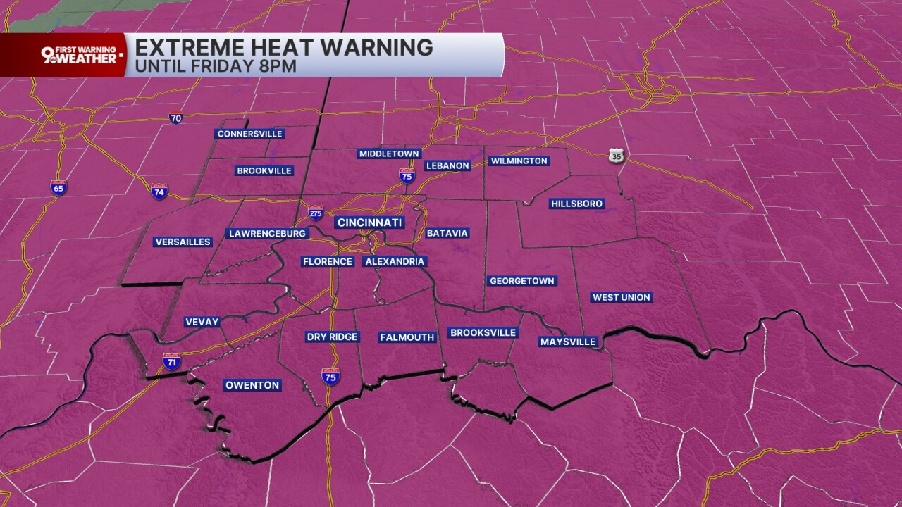
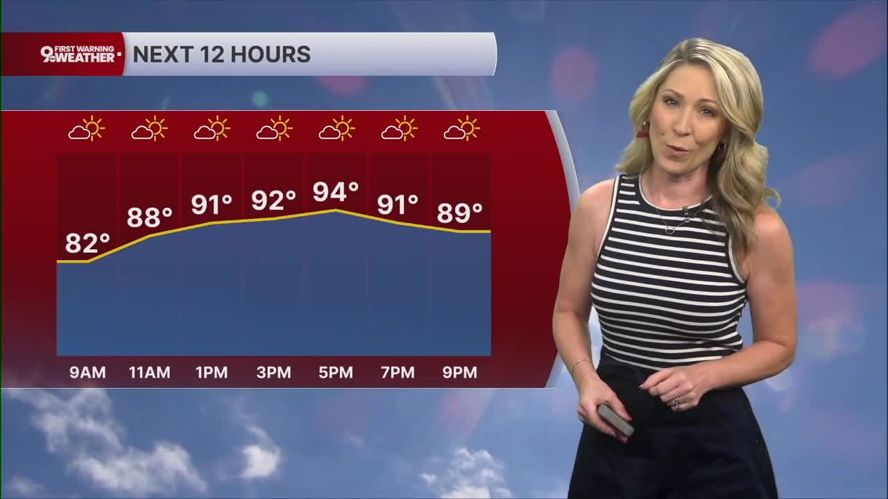
Temperatures start in the mid-70s and we'll warm to 94 this afternoon under a partly cloudy sky. The afternoon heat index will range from 100 to 105 across our region.
There is a small storm chance as well, but it won't come into play until the late evening hours. The storm chance is only 30% so the majority of us won't see storms today. For those who do see storms, damaging wind gusts will be possible. The SPC has our area in a marginal risk of severe weather.
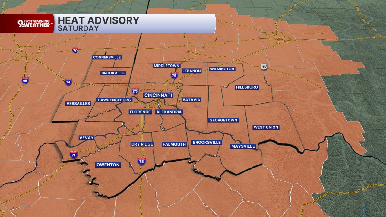
The Fourth of July will still be hot and humid. Highs rise to 92 degrees with heat index values between 99 and 103 degrees. The NWS has issued a heat advisory for Saturday.
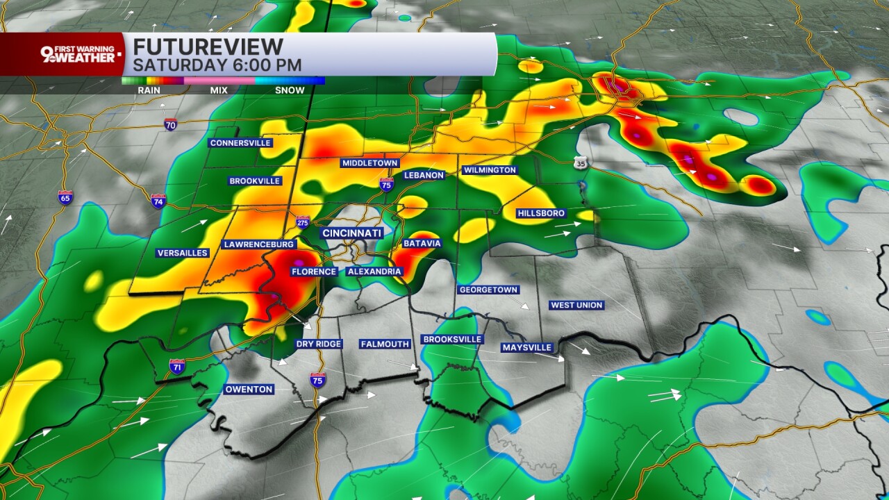
The bigger story on Saturday will be the return of showers and storms and how that impacts your day.
We'll see isolated rain chances in the morning hours. Scattered storms will start popping between 2 and 4 p.m. across the Tri-State and these storms could bring big downpours and even isolated severe wind gusts. Widely scattered showers and storms are likely from 4 to 8 p.m. After 8 p.m., storms should start to lose strength and subside. I still can't rule out isolated showers when fireworks displays begin but again, storms should be fading. The outlook is looking better for fireworks.

Spotty storms will again be possible on Sunday as highs rise to the upper 80s.
Something else to think about this weekend is that our air quality is not in the best shape. The Southwest Air Quality Agency has issued an air quality alert for the Cincinnati metro area through Sunday.
MORNING RUSH
Warm and hazy
Dry
Low: 76
FRIDAY
Partly cloudy
Slight evening storm chance
High: 94
FRIDAY NIGHT
Evening storms fade
Warm, very muggy
Low: 74
4TH OF JULY
Scattered afternoon storms
Heat advisory
High: 92
SATURDAY NIGHT
Evening storms fade
Partly cloudy, muggy
Low: 73
SUNDAY
Spotty afternoon storms
Still very humid
High: 89
9 First Warning Weather 24/7 Livestream
==========
- Interactive Radar: Track weather to your doorstep
- Sign up for severe weather email alerts
- Check latest school closings and delays
- WCPO traffic updates
- Metro bus detours and updates (or call the hotline at 513-632-7538)
- Latest power outages from Duke Energy
- Flight cancellations and delays from CVG, other U.S. airports
