


What an awesome forecast...It continues all this week, but we do have a slight chance for rain on Thursday.
As for the morning, it'll be downright chilly in spots as lows fall to the upper 40s by daybreak. The effect of the Canadian cold front is now taking hold on the Tri-State.

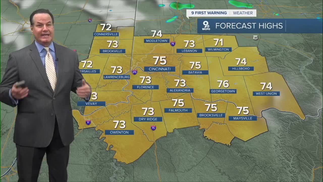
Tuesday will feel fall-like as well with highs that only reach the low to mid-70s in most communities. While afternoon highs will gradually climb to near 80 degrees, the humidity will not be a factor entering into the Labor Day weekend. So, below-average temps continue for the entire week ahead.

OVERNIGHT
Mostly clear
Chilly
Low: 54
TUESDAY
Mostly sunny
Light breeze
High: 75
TUESDAY NIGHT
Mostly clear
Chilly
Low: 53
9 First Warning Weather 24/7 Livestream
==========
- Interactive Radar: Track weather to your doorstep
- Sign up for severe weather email alerts
- Check latest school closings and delays
- WCPO traffic updates
- Metro bus detours and updates (or call the hotline at 513-632-7538)
- Latest power outages from Duke Energy
- Flight cancellations and delays from CVG, other U.S. airports
