


Overnight into Wednesday morning, we could see a spotty shower, wintry mix, or even a few snowflakes before daybreak, but skies should break later for mainly sunshine and highs in the low to mid-50s.
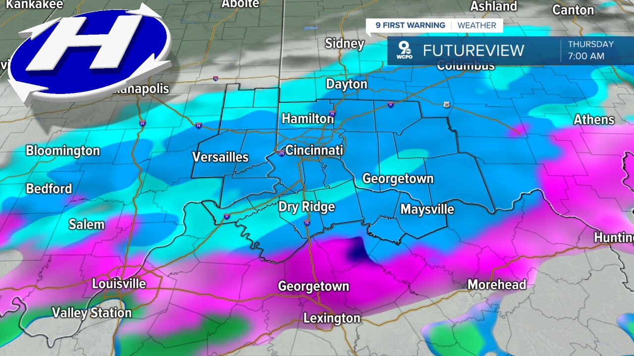
As we move toward Thursday, another clipper shoots through the region, and we'll likely see some light snow similar to what we just went through. The snow may mix with some rain before shutting down by about 10 am as the skies stay mostly cloudy. Highs drop to the low to mid 40s, seasonal.
A mostly sunny Friday offers a pleasant break with highs in the mid-50s. Saturday looks a bit milder and still dry and mostly sunny as highs push to near 60 degrees. However, late Saturday night and Sunday trend toward more clouds.
There's a lot more uncertainty in the forecast early next week. As early as Sunday night, we could start to see rain in the Tri-State. This could continue at times through Tuesday. With highs staying in the mid 40s, it looks like a lot of this will be rain, but we can't rule out some of it mixing with or changing into snow at times.
OVERNIGHT
Spotty rain, mix, light snow
Steady temps
Low: 35
WEDNESDAY
Clearing skies
Warmer
High: 52
WEDNESDAY NIGHT
Wintry mix moves in
Falling temperatures
Low: 33
9 First Warning Weather 24/7 Livestream
==========
- Interactive Radar: Track weather to your doorstep
- Sign up for severe weather email alerts
- Check latest school closings and delays
- WCPO traffic updates
- Metro bus detours and updates (or call the hotline at 513-632-7538)
- Latest power outages from Duke Energy
- Flight cancellations and delays from CVG, other U.S. airports
