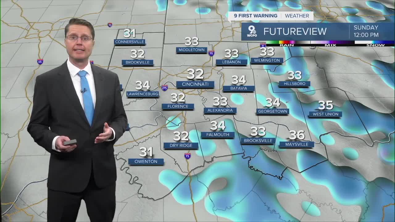


We will be mostly cloudy as we drop into the upper 20s for Sunday morning. Around 7 or 8 in the morning, scattered snow will start to slide south into the Tri-State. The snow will continue on and off the rest of the day, keeping us mostly cloudy. It will also be a little windy as colder air blows in, keeping highs in the low 30s. The bulk of the snow will end Sunday night.

Thanks to the recent warm weather, a lot of the snow will melt as it falls. Grassy areas and raised surfaces like your decks and cars have a better chance of seeing some snow stick. Any totals should stay under an inch, but watch for slick spots where the snow sticks.
We stay below average and a little windy Monday with low 30s and mostly cloudy skies. There could be a few flurries around too.
Tuesday brings a little more sunshine and a high closer to 40 as we start to warm back up.
Low 50s look likely Wednesday. Most of the day will be dry, but our next round of rain could arrive as early as Wednesday night as an area of low pressure moves east through the Midwest.
Most of the rain will fall Thursday, dropping highs down into the upper 40s for the afternoon. As colder air wraps around the back of the low pressure center, we could see the last bit of rain change into a little snow before completely drying out Thursday night. Accumulation is not expected right now.

The sunshine is back Friday, getting us back to 50!
The first half of next weekend looks warmer than the second half. Saturday will be in the mid 50s, but we drop into the mid 40s for Sunday. For now, both days could bring a few pockets of rain or snow across the region.
OVERNIGHT
Mostly cloudy
Flurries begin
Low: 28
SUNDAY
Mostly cloudy
Snow likely
Windy
High: 33
SUNDAY NIGHT
Mostly cloudy
Leftover flurries
Low: 24
MONDAY
Mostly cloudy
Flurries
Windy
High: 33
9 First Warning Weather 24/7 Livestream
==========
- Interactive Radar: Track weather to your doorstep
- Sign up for severe weather email alerts
- Check latest school closings and delays
- WCPO traffic updates
- Metro bus detours and updates (or call the hotline at 513-632-7538)
- Latest power outages from Duke Energy
- Flight cancellations and delays from CVG, other U.S. airports
