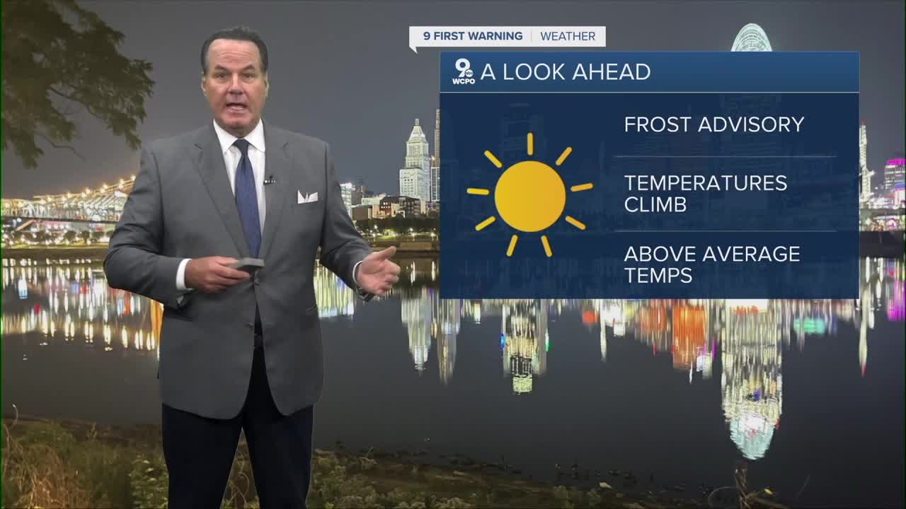


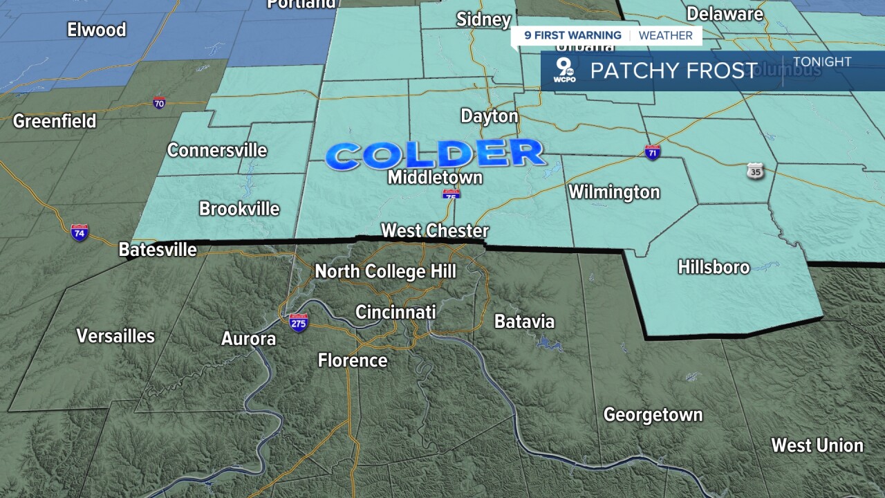
The sky stays mostly clear, and this is going to allow the temperature to drop into the upper 30s for most neighborhoods. North of Cincinnati, the temps will fall a bit more, ranging from 34-37 degrees. This is where we will see some isolated reports of frost. A FROST ADVISORY has been issued ( check out the map below ).
On another note...we received an update on our drought conditions, and there was slight improvement around the area. However, we will go several days without any rain chances again.

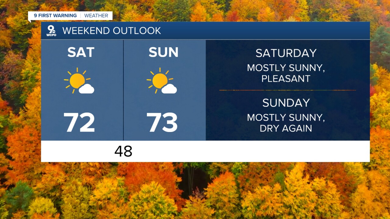
Looking ahead to tomorrow...the forecast looks milder. The sky will be mostly sunny as temperatures climb to 70 degrees. A few clouds move in late Friday night into early Saturday as a weak cold front passes through the Ohio Valley. It will not bring in any rainfall.
Temperatures over the weekend will end up in the low 70s on both days with mostly sunny conditions. It will be a great weekend, and the dry weather continues into next week's forecast as well.
TONIGHT
Clear and colder
Patchy frost possible
Low: 40
FRIDAY
Mostly sunny
Ideal
High: 70
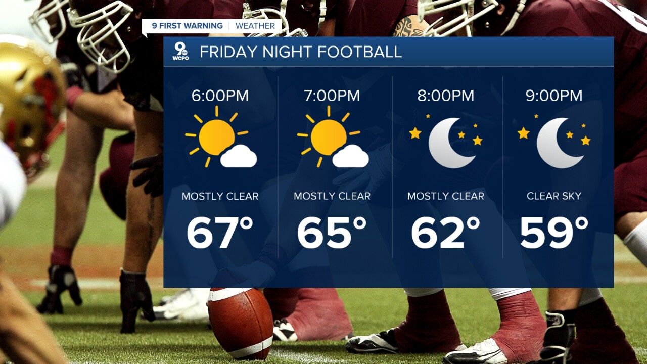
FRIDAY NIGHT
Mostly cloudy
Not as cold
Low: 48
9 First Warning Weather 24/7 Livestream
==========
- Interactive Radar: Track weather to your doorstep
- Sign up for severe weather email alerts
- Check latest school closings and delays
- WCPO traffic updates
- Metro bus detours and updates (or call the hotline at 513-632-7538)
- Latest power outages from Duke Energy
- Flight cancellations and delays from CVG, other U.S. airports
