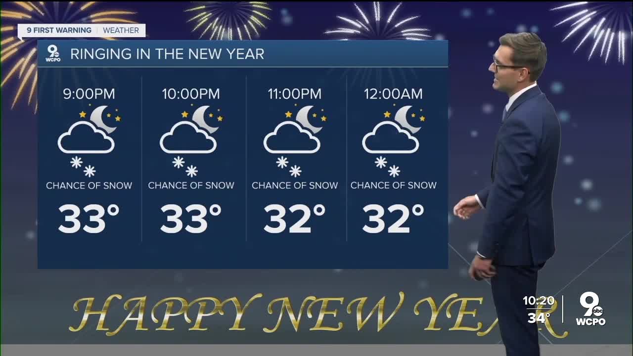


It's a cloudy and cold start to the new year in the Tri-State!
Light snow may fall steadily at times and continue through the overnight. A few quick bursts of snow could briefly reduce visibility and cause some slick spots on roads, bridges and sidewalks.
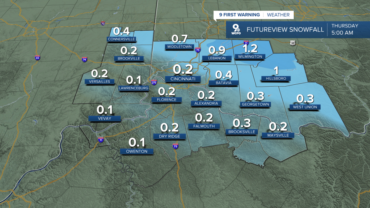
In the Greater Cincinnati area, snow accumulation is expected to remain at one-half inch or less. Many surfaces may just see a light coating. Areas north and west of Cincinnati are more likely to see higher totals, closer to an inch or slightly more, where colder air allows snow to stick more easily.
The snow machine turns off early on New Year's Day as the quick-moving system exits the region. Clouds will give way to some sunshine by the afternoon with highs near 32.
Looking ahead, expect a long stretch of drier conditions with little to no rain or snow in the near future. Temperatures will gradually warm above freezing over the next few days. Highs near 50 on Monday.
NEW YEAR'S DAY
Partly sunny
Still cold
High: 32
9 First Warning Weather 24/7 Livestream
==========
- Interactive Radar: Track weather to your doorstep
- Sign up for severe weather email alerts
- Check latest school closings and delays
- WCPO traffic updates
- Metro bus detours and updates (or call the hotline at 513-632-7538)
- Latest power outages from Duke Energy
- Flight cancellations and delays from CVG, other U.S. airports
