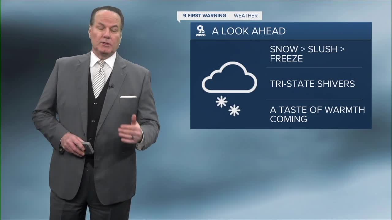


As we head toward the weekend, Greater Cincinnati will see a combination of light snow and uncomfortable arctic air as well as a slow thaw toward early next week.
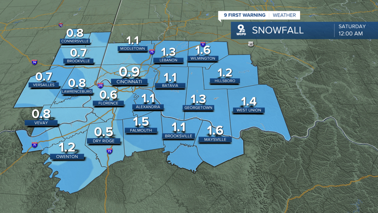
Friday will start off with a wintry greeting as a clipper system moves through the region. Expect a light to moderate snow in the mid-morning to early afternoon hours that could leave a light coating on roads and grassy areas.
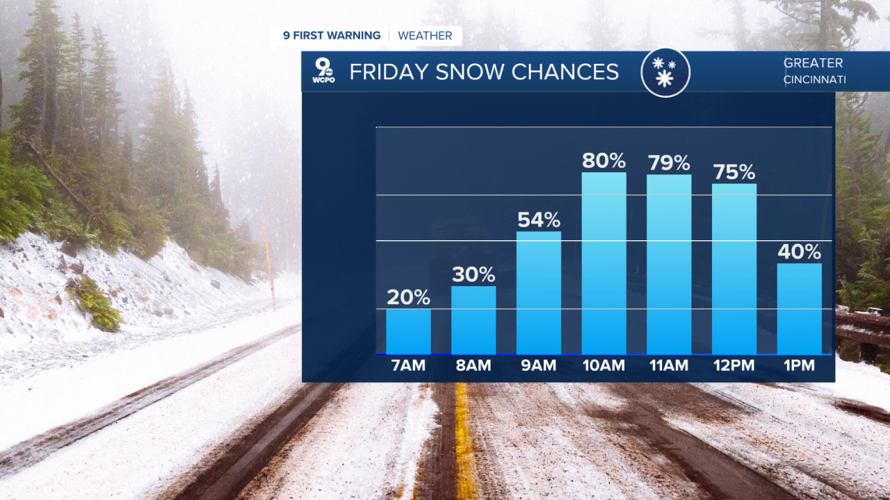
Temperatures will climb into the upper 30s by the afternoon, warm enough to melt much of that quick-falling snow, but don’t be surprised if any wet spots refreeze overnight as temps fall back into the single digits.
Saturday's breezy conditions may have you digging out your thicker coat again before your plans for the day. Sunshine will be around, and the cold firmly in charge. Highs will barely make it to about 20 degrees while overnight lows dip back down into the single digits. Wind chill values will make it feel much colder, so outdoor plans will require serious layering.
Sunday offers a slight reprieve from the morning’s frigid bite with highs returning to the upper 20s. Skies will be mostly cloudy, and while significant precipitation isn’t in the forecast, the chill will linger in every breath of wind. Nighttime temperatures will hover in the low teens, keeping most of the weekend firmly in winter’s grip.
OVERNIGHT
Overcast
Chance Flurries
Low: 20
FRIDAY
Light snow
Accumulation about 1" to 1.5"
High: 37
FRIDAY NIGHT
Mostly clouds
Flurries continue
Low: 10
9 First Warning Weather 24/7 Livestream
==========
- Interactive Radar: Track weather to your doorstep
- Sign up for severe weather email alerts
- Check latest school closings and delays
- WCPO traffic updates
- Metro bus detours and updates (or call the hotline at 513-632-7538)
- Latest power outages from Duke Energy
- Flight cancellations and delays from CVG, other U.S. airports
