


Colder mornings are expected this week, with rain arriving by midweek. Then, a true cold snap for the weekend.
Sunday was actually warm compared to where we've been the last 10+ days. However, we still ended up just below average. We have not been at or above average since the day before Thanksgiving.
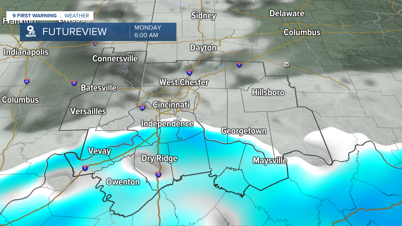
But tonight we will quickly have temps fall into the 20s again with even a few flurries possible with some light accumulations possible in our southern counties.
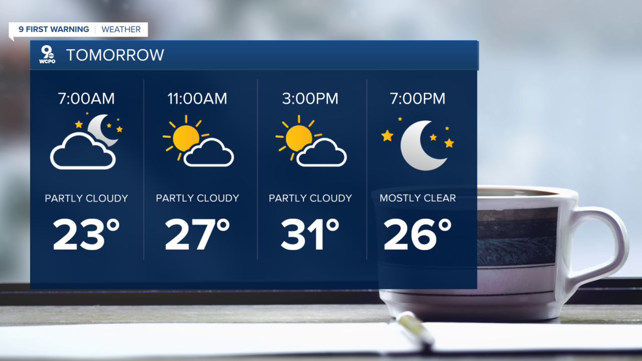
Highs on Monday won't be nearly as warm as Sunday. Expect to top out in the low 30s.
Wednesday looks to be our mildest day of the week, with temperatures reaching the mid-40s. The trade-off will be rain, which could fall through much of the day.
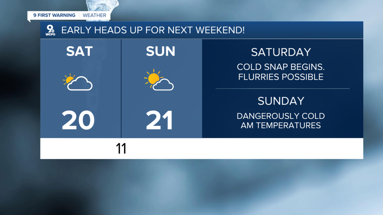
Next weekend, BRRR! As of right now we are forecasting highs around 20 with overnight lows near the single digits.
TONIGHT
Mostly cloudy
Few flurries late
Low: 23
MONDAY
Cloudy start
AM flurries
High: 30
MONDAY NIGHT
Mostly clear
Calm
Low: 19
9 First Warning Weather 24/7 Livestream
==========
- Interactive Radar: Track weather to your doorstep
- Sign up for severe weather email alerts
- Check latest school closings and delays
- WCPO traffic updates
- Metro bus detours and updates (or call the hotline at 513-632-7538)
- Latest power outages from Duke Energy
- Flight cancellations and delays from CVG, other U.S. airports
