


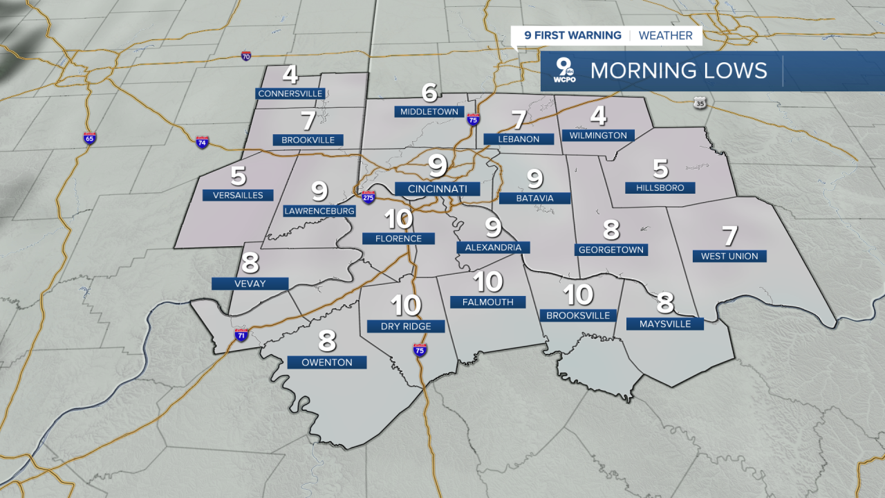
As of now, Greater Cincinnati is digging its heels into a classic February chill. Tonight will be cold with periods of clouds and clear skies, but temperatures will drop to frigid lows tumbling into the teens and single digits. Wind chills will make it feel even colder at times, so hats and warm layers are going to be your best friends.
Thursday continues the cold theme with highs barely above the lower 20s, and nights even colder. Expect a mostly cloudy sky with a bit of sunshine trying to break through now and then.

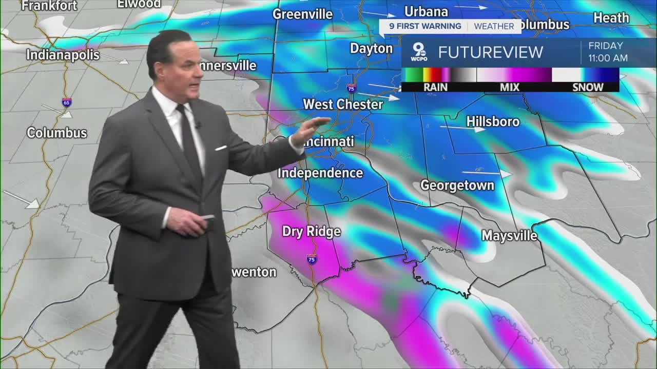
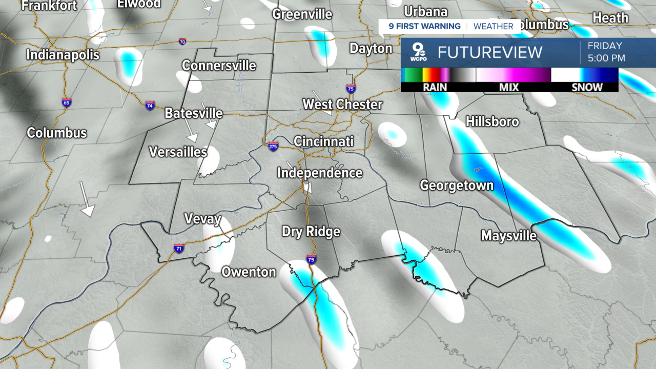
By Friday, that cold air starts to back off just a touch, but there’s a chance for some snow showers in the morning, mainly light stuff, but enough that a dusting to a half-inch could create slick spots. Highs should reach the mid-30s, so we could see some wintry mix.
Saturday looks mostly sunny, but don’t let the sunshine fool you. It’ll still be bitterly cold with highs in the low 20s, and overnight wind chills will make it feel well below zero in many spots.
Heading into Sunday, we see more clouds and highs again in the upper 20s. Plus, there's s light chance for more light snow.
Next week, we finally see the temperatures rebound to average and push into the above-average territory, and reach near 50 degrees!
OVERNIGHT
Partly cloudy
Cold
Low: 9
THURSDAY
Partly to mostly cloudy
Chilly again
High: 26
THURSDAY NIGHT
Flurries possible
Mostly cloudy
Low: 20
9 First Warning Weather 24/7 Livestream
==========
- Interactive Radar: Track weather to your doorstep
- Sign up for severe weather email alerts
- Check latest school closings and delays
- WCPO traffic updates
- Metro bus detours and updates (or call the hotline at 513-632-7538)
- Latest power outages from Duke Energy
- Flight cancellations and delays from CVG, other U.S. airports
