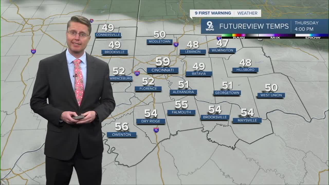


The rest of our Christmas will be cloudy with some mist and drizzle in foggy areas. Even though things look pretty gray, temperatures stay well above Cincinnati's average high of 41.
Mid and upper 50s will be common along and north of the Ohio River, but low 60s are more likely south of Greater Cincinnati.
Light, scattered rain will return early Friday morning and continue at times the second half of the day, but a warm front will briefly blow in some warmer weather, pushing us into the low 60s.
A cold front quickly follows, dropping us back down into the upper 50s for Saturday. It should be dry with upper 50s and a lot of clouds.
Another push of warmer air comes in Sunday ahead of an arctic cold front.
This will get us into the mid 60s Sunday, but it will be wet at times. From late morning to the afternoon, including during the Bengals game, there will be some lighter scattered rain around the Tri-State.
When the cold front arrives later in the day, the rain could be heavier at times and more widespread across the region.
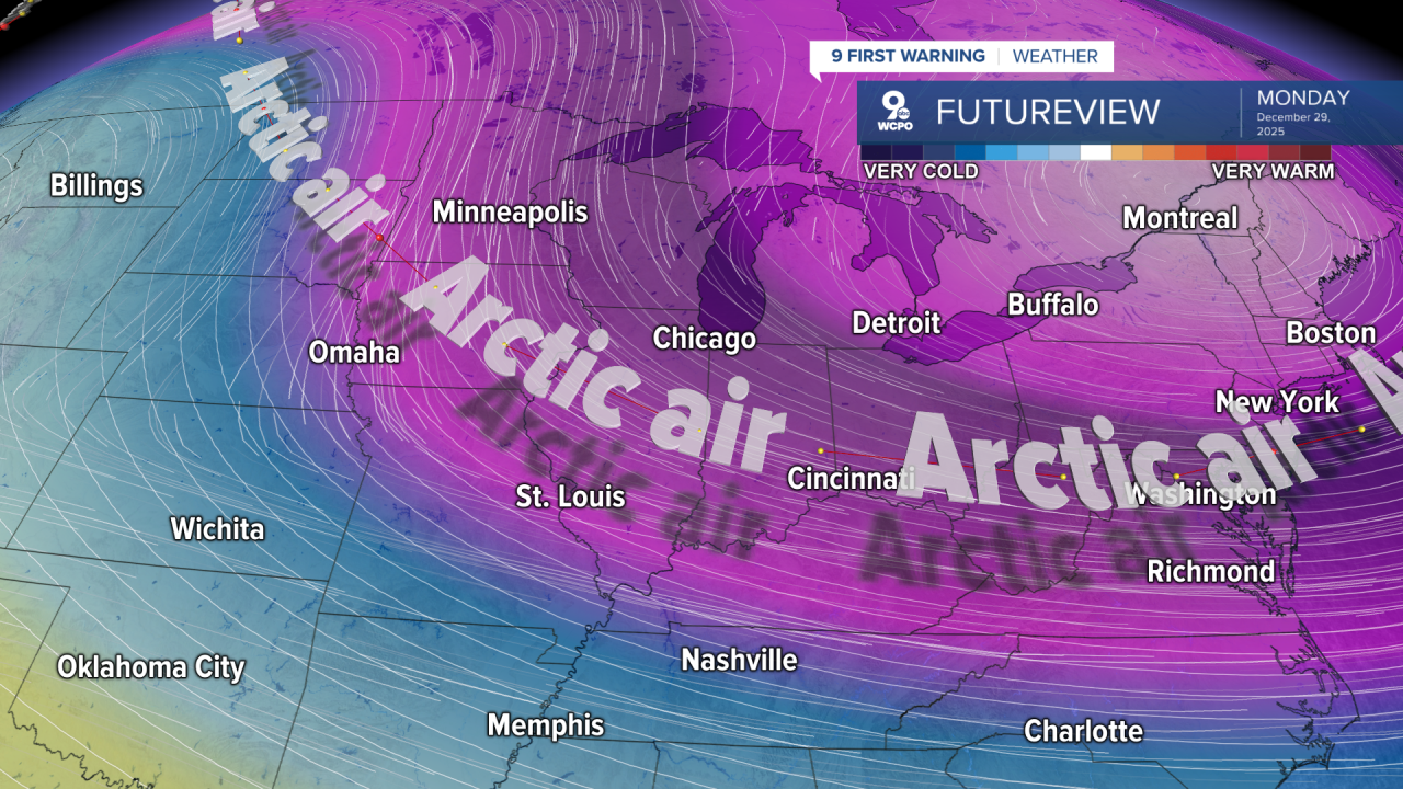
The rain ends by the Monday morning commute, but it will get windy as much colder weather blows in. We will only make it into the upper 20s Monday afternoon, but it will be mostly sunny.
Tuesday likely starts in the teens, followed by highs in the mid 20s with a mix of sun and clouds.
The 30s return midweek for the start of 2026.
CHRISTMAS
Cloudy
Foggy areas
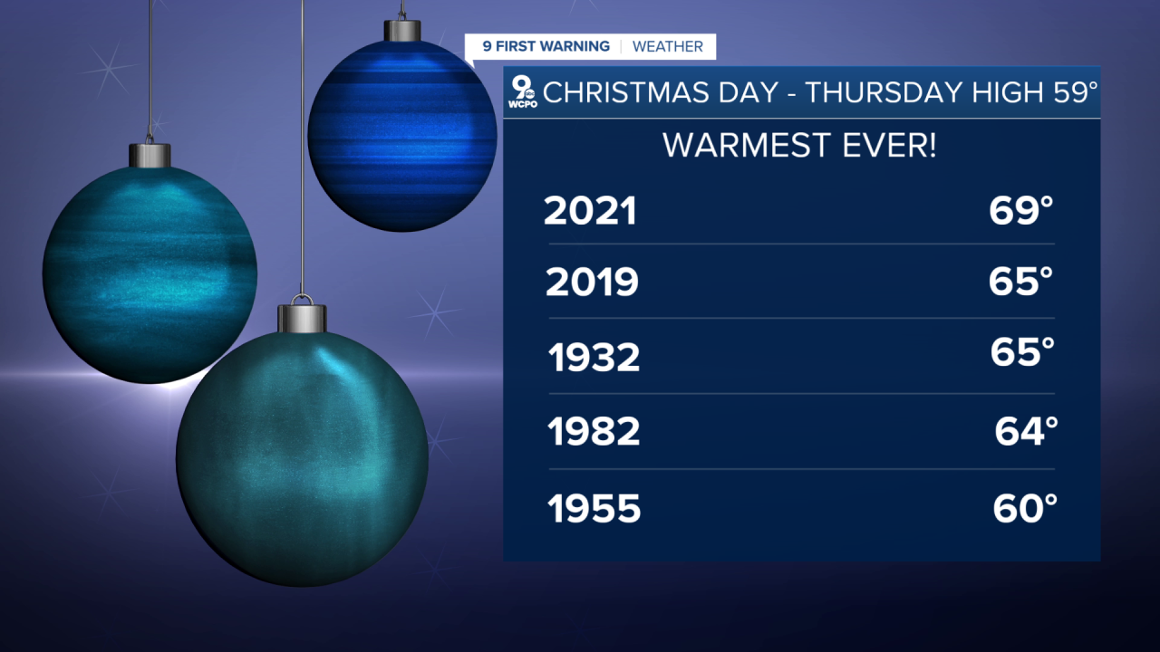
High: 59
THURSDAY NIGHT
Cloudy
Mild
Low: 46
FRIDAY
Cloudy
Scattered rain
High: 63
SATURDAY
Mostly cloudy
Cooler
High: 57
9 First Warning Weather 24/7 Livestream
==========
- Interactive Radar: Track weather to your doorstep
- Sign up for severe weather email alerts
- Check latest school closings and delays
- WCPO traffic updates
- Metro bus detours and updates (or call the hotline at 513-632-7538)
- Latest power outages from Duke Energy
- Flight cancellations and delays from CVG, other U.S. airports
