


Christmas Eve got off to a quiet but somewhat murky start, with areas of morning fog.
As the fog lifts by mid-morning, sunshine will take over, setting the stage for a mild and pleasant Christmas Eve. Afternoon temperatures will rise above normal for late December, making it feel more like early November than the holiday season. We'll top out with a high of around 51 degrees.
Conditions will begin to change on Christmas Eve night as a cold front approaches from the west. Clouds will increase through the evening, and scattered showers will develop about the 8-9 pm time frame. Rainfall will generally be light and spotty, but wet roads are likely for late-night travel.
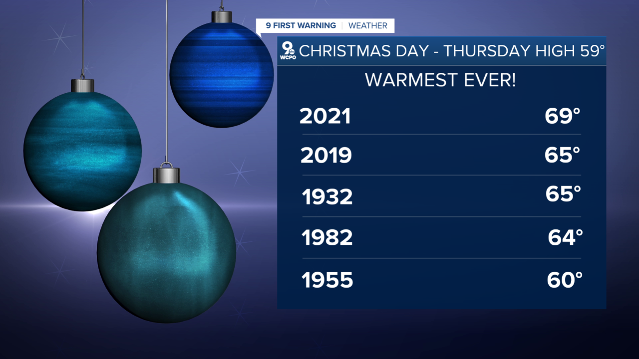
Christmas morning will start mostly cloudy with isolated, lingering showers, especially early in the day. Any rain will taper off by mid-morning, leaving behind a dry but cloudy sky for the rest of the holiday. Despite the lack of sunshine, temperatures will remain unusually mild. Christmas afternoon highs will climb into the upper 50s, just shy of Cincinnati’s record Christmas Day high of 69 degrees set in 2021.
The warm pattern doesn’t stop there. Another weather system arrives Friday, bringing another round of showers, but this front will actually usher in an even warmer air mass. Afternoon highs will surge into the 60s Friday and Saturday, exceptionally warm for late December and more than 20-25 degrees above average.
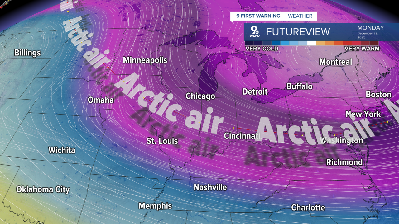
The dramatic shift arrives on Sunday. A strong Arctic front will sweep through, bringing falling temperatures throughout the day. What starts relatively mild will turn sharply colder by evening. Be prepared if you're going to Paycor, as it will get cooler through the Bengals' game.
By Monday morning, temperatures will bottom out in the teens, reminding us that winter is far from over.
WEDNESDAY
Partly cloudy, cooler
Late day rain chance
High: 51
WEDNESDAY NIGHT
Scattered showers
Overcast
Low: 45
9 First Warning Weather 24/7 Livestream
==========
- Interactive Radar: Track weather to your doorstep
- Sign up for severe weather email alerts
- Check latest school closings and delays
- WCPO traffic updates
- Metro bus detours and updates (or call the hotline at 513-632-7538)
- Latest power outages from Duke Energy
- Flight cancellations and delays from CVG, other U.S. airports
