


Overall, it's a quiet night around the Tri-State as a cold front covers the sky.
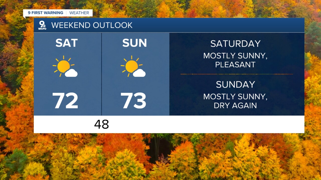
The front will bring a few clouds into the area to start our weekend. At times, we'll see partly cloudy skies but afternoon highs will still be seasonal.
Temperatures over the weekend will end up in the low 70s on both days with mostly sunny conditions. It will be a great weekend to do just about anything you want outside! The dry weather continues into next week's forecast as well.
WCPO
TONIGHT
Mostly cloudy
Not as cold
Low: 48
SATURDAY
Partly cloudy
Seasonal
High: 72
TONIGHT
Mostly clear
Not as cold
Low: 48
SUNDAY
Mostly Sunny
Warmer
High: 73
9 First Warning Weather 24/7 Livestream
==========
- Interactive Radar: Track weather to your doorstep
- Sign up for severe weather email alerts
- Check latest school closings and delays
- WCPO traffic updates
- Metro bus detours and updates (or call the hotline at 513-632-7538)
- Latest power outages from Duke Energy
- Flight cancellations and delays from CVG, other U.S. airports
