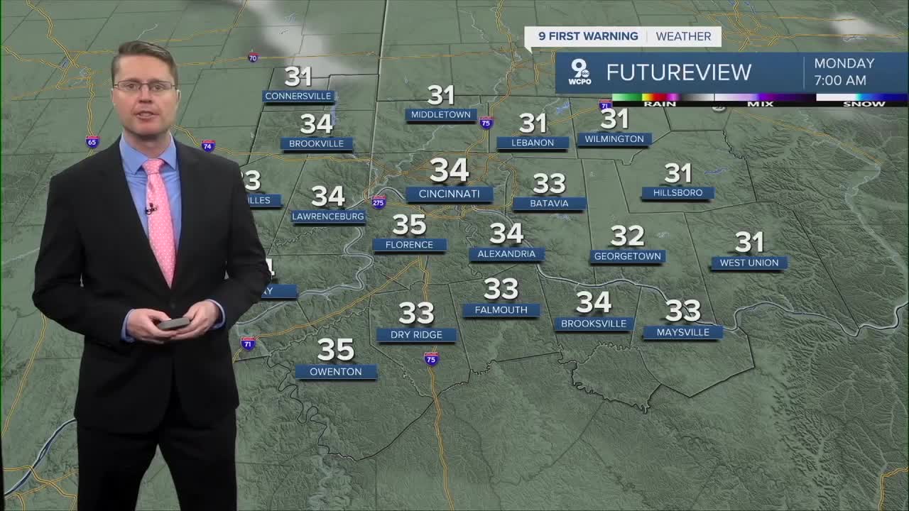


As the wind lightens up and skies clear overnight, temperatures will tumble. Frosty areas will be possible across Greater Cincinnati as we drop down into the mid 30s. Outside of the city, especially north, some spots will drop below freezing. Protect any sensitive plants before heading to bed Sunday night.
Monday looks like the coolest day of the week with highs in the mid 50s, but it will be mostly sunny.

It gets a bit breezy Tuesday as warmer weather blows back in from the south. After starting the day in the upper 30s, we will warm into the the mid 70s with a lot of sunshine.
Wednesday morning, scattered rain will push into the Tri-State. Some of the rain will continue into the afternoon, but some cities will stay dry. Highs will be in the low 70s with a lot more clouds.
We warm into the upper 70s Thursday with a mix of sunshine and clouds. Friday will be breezy with upper 70s.
A cold front arrives late Friday and into Saturday, which will bring a better chance for more of us to see rain, but it's a little too early to say if more of this rain will be on Friday or Saturday.

The cold front drops us down the low 70s Saturday afternoon, followed by upper 60s on Sunday.
Another round of widespread rain is possible next Monday and Tuesday.
OVERNIGHT
Clearing skies
Frost possible
Low: 34
MONDAY
Mostly sunny
Very cool
High: 56
MONDAY NIGHT
Mostly clear
Cold
Low: 38
TUESDAY
Mostly sunny
Breezy
High: 74
9 First Warning Weather 24/7 Livestream
==========
- Interactive Radar: Track weather to your doorstep
- Sign up for severe weather email alerts
- Check latest school closings and delays
- WCPO traffic updates
- Metro bus detours and updates (or call the hotline at 513-632-7538)
- Latest power outages from Duke Energy
- Flight cancellations and delays from CVG, other U.S. airports
