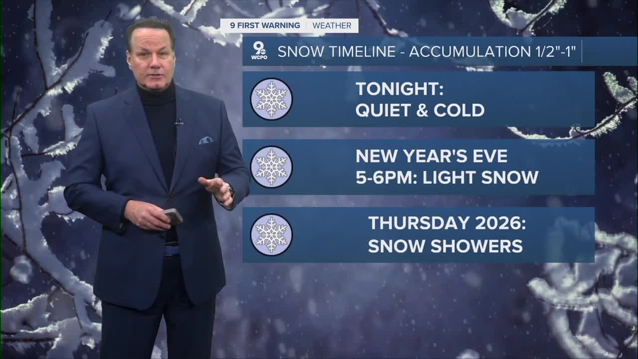


Cold weather will continue in Cincinnati tonight with mostly cloudy skies. Temperatures will fall into the mid-20s, and while most of the night will be dry, a few light snowflakes are possible late. Roads should remain in good shape overnight.
On Wednesday, New Year’s Eve, the day will be cold and mostly cloudy with afternoon highs in the mid-30s. The most important weather change comes later in the day. Light snow is expected to begin between about 5 and 6 pm, which could affect evening travel and outdoor plans. The snow will be light but may fall steadily at times and continue through the evening and overnight.
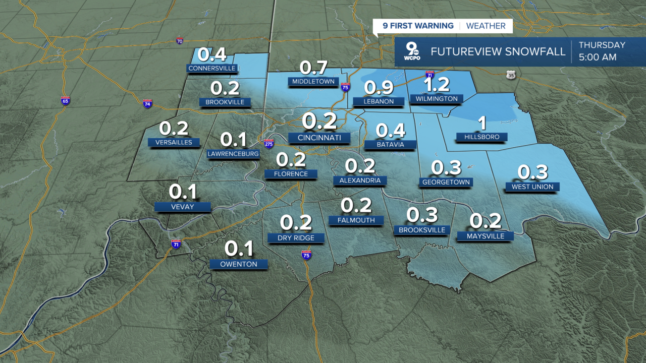
This will not be a heavy snow, but it could still create slick spots on roads, bridges, and sidewalks, especially after sunset when temperatures drop closer to freezing. In the Greater Cincinnati area, snow accumulation is expected to remain at one-half inch or less. Many surfaces may just see a light coating. Areas north and west of Cincinnati are more likely to see higher totals, closer to an inch or slightly more, where colder air allows snow to stick more easily.
The reason snow amounts will stay low is that this weather system is moving quickly and does not have much moisture. Also, temperatures will be near freezing when the snow begins, which limits how much snow can build up on roads and other surfaces.
By early Thursday morning, New Year’s Day, the snow will come to an end. Clouds will slowly decrease during the day, and it will stay cold with highs in the low 30s. Any slick spots left over from the night before should improve as the day goes on.
Looking ahead to the weekend, the weather looks mostly dry and cold. Daytime highs will be in the upper 30s to low 40s, and no major winter storms are expected. Overall, this will be a minor snow event, but drivers should still use caution on Wednesday night.
TONIGHT
Mostly cloudy
Cold
Low: 25
WEDNESDAY
Some sun early
Mostly cloudy
High: 35
WEDNESDAY NIGHT
Increasing clouds
Light snow
Low: 23
9 First Warning Weather 24/7 Livestream
==========
- Interactive Radar: Track weather to your doorstep
- Sign up for severe weather email alerts
- Check latest school closings and delays
- WCPO traffic updates
- Metro bus detours and updates (or call the hotline at 513-632-7538)
- Latest power outages from Duke Energy
- Flight cancellations and delays from CVG, other U.S. airports
