


Expect periods of steady showers, especially through the early morning commute, with a chance for thunderstorms. Make sure the kids at the bus stop have an umbrella or jacket, and you might want to leave earlier for work.

Many areas could pick up a healthy one to two inches of rain before the wet weather winds down. Then, scattered rain continues through the day before a line of heavy rain with a chance of thunderstorms hits again around dinnertime due to a cold front now located to our northwest.

By Tuesday night, the front slides through, and you will notice the change almost instantly. Cooler, drier air filters in as the wind turns out of the north, setting up a much more comfortable stretch of weather.

Highs on Wednesday will top out in the 60s, Sunshine makes a comeback too, and a light breeze will add to that crisp fall feel.
Morning lows will dip into the 40s several times between Thursday and the weekend. You may want to dig out the sweaters and jackets, because the cool mornings and mild afternoons will finally make it feel like autumn.
OVERNIGHT
Scattered Showers
Low: 65
TUESDAY
Morning Rain, chance thunderstorms
Scattered showers through the day
Evening Rain again
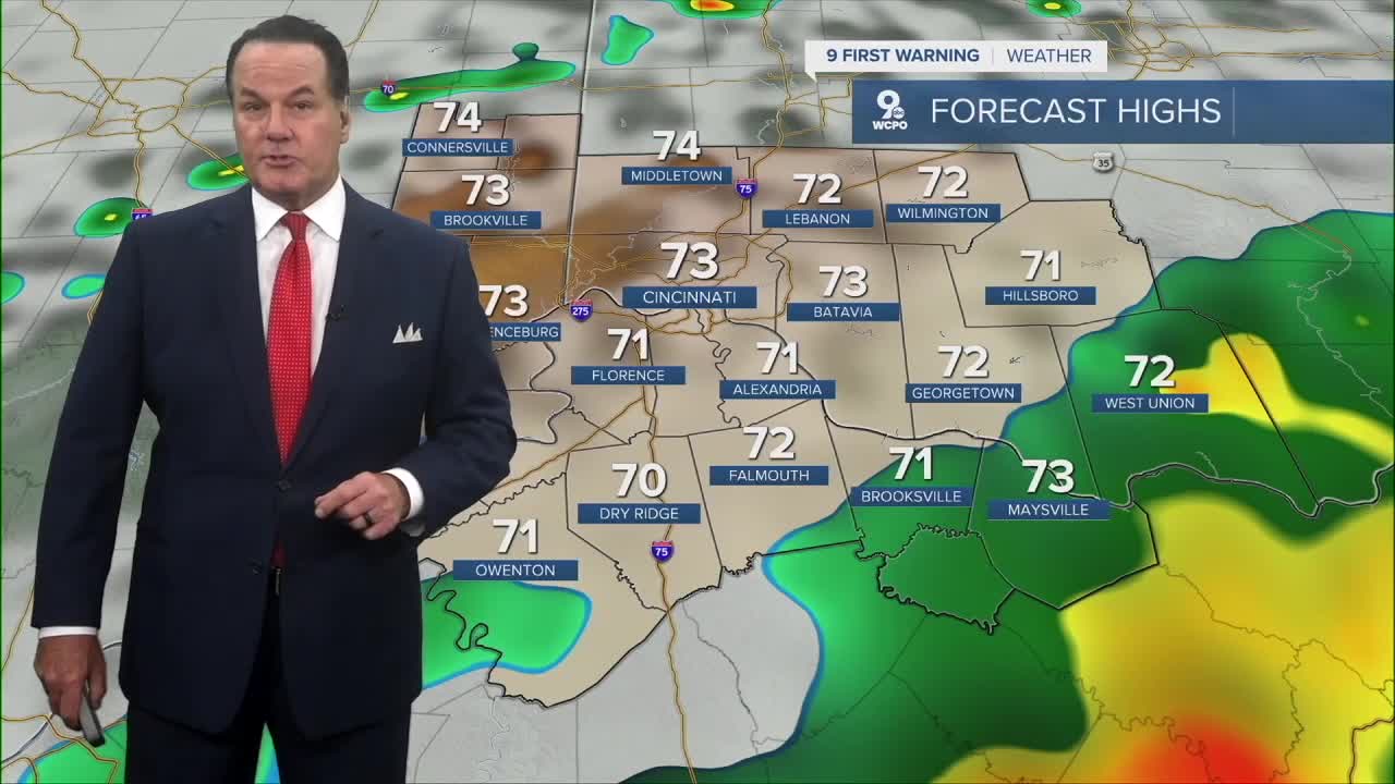
High: 73
TUESDAY NIGHT
Showers Ending
Low: 54
9 First Warning Weather 24/7 Livestream
==========
- Interactive Radar: Track weather to your doorstep
- Sign up for severe weather email alerts
- Check latest school closings and delays
- WCPO traffic updates
- Metro bus detours and updates (or call the hotline at 513-632-7538)
- Latest power outages from Duke Energy
- Flight cancellations and delays from CVG, other U.S. airports
