



Is summer back?
Temperatures will be warmer today, rising to the mid-80s with a partly cloudy sky. Thankfully, humidity isn't rising too much today so there won't be a heat index. But it definitely feels like a late summer day. Light winds will continue from the south at 3 to 5 mph.
We'll only cool to 64 degrees tonight which means it's just generally warm tonight. Winds are still light too.
Then our winds increase on Thursday to the southwest at 10 to 15 mph and this will help increase temperatures again. Highs are expected around 88 degrees on Thursday. While humidity is rising during the day, it will barely feel sticky by the end of the day. The sky will be partly cloudy tomorrow.
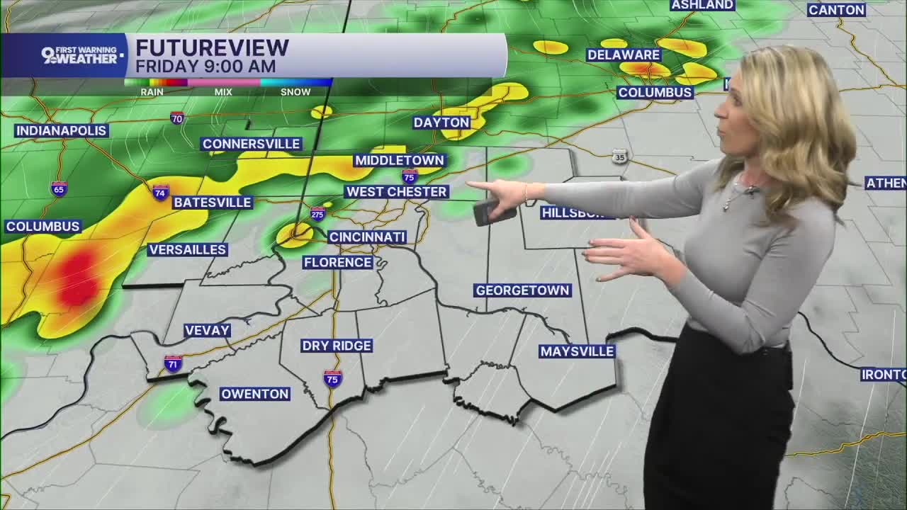
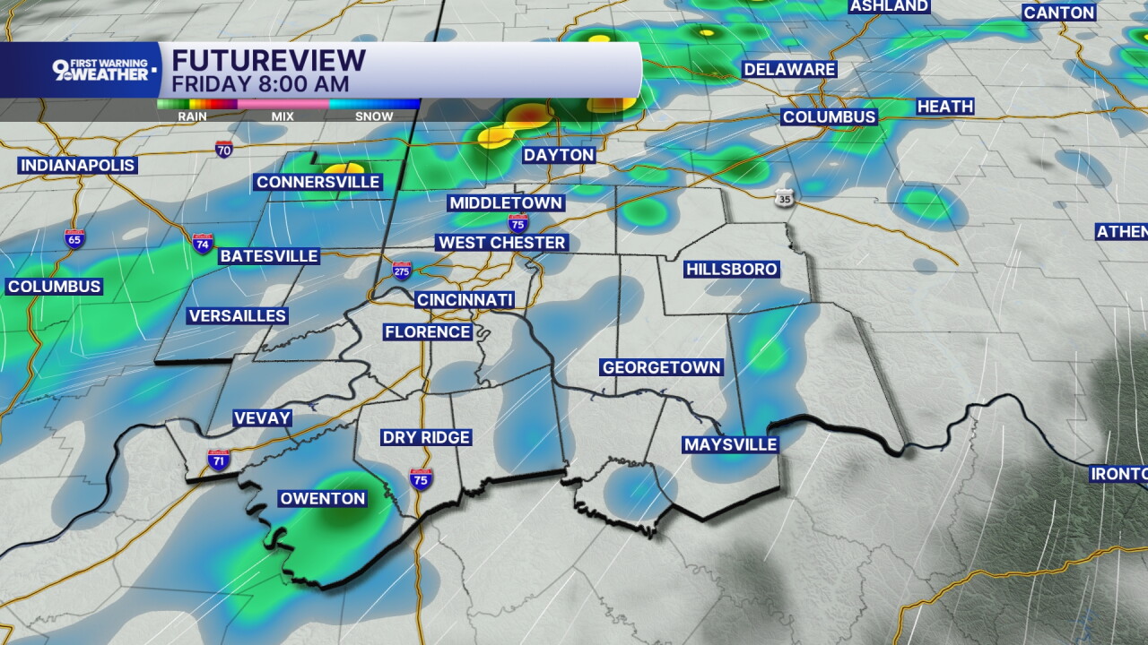
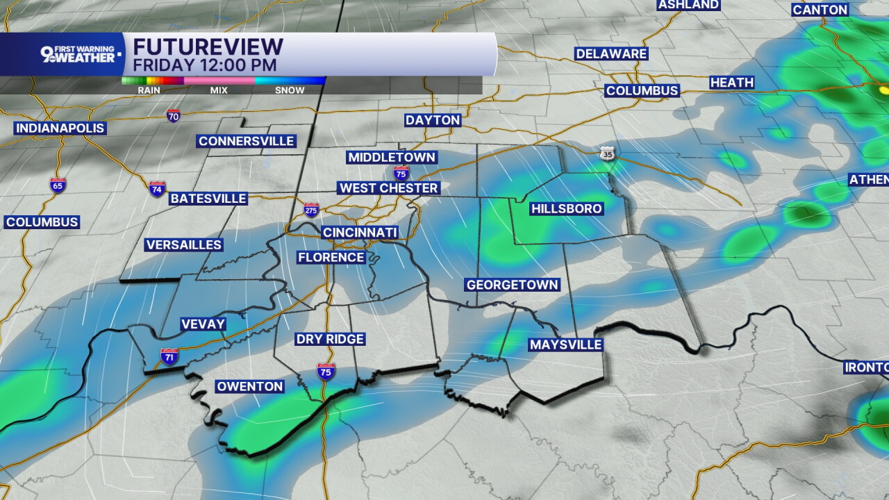
We have one chance for rain in the extended forecast and that will be the low-pressure system passing on Friday. Scattered showers and storms will arrive between 6-9 a.m. to our northwestern locations and then pass across most of the area from 9 a.m. to 2 p.m. Scattered rain activity will drop 0.25" of rain or less. While we could see an isolated shower through 4 p.m., most of the rain should be out of here in time for our Friday night football games. Temperatures will only warm to 73 degrees on Friday and temperatures should be around 67 degrees when football games begin.
Cooler air settles into the Tri-State for the weekend and the forecast looks dry for Saturday and Sunday. Highs will be around 70 degrees both days.
MORNING RUSH
Few clouds
Mild
Low: 57
WEDNESDAY
Partly cloudy
Warmer
High: 85
WEDNESDAY NIGHT
Partly cloudy
Warm
Low: 64
THURSDAY
Partly cloudy
Hot
High: 88
THURSDAY NIGHT
Mostly cloudy
Slight rain chance
Low: 68
9 First Warning Weather 24/7 Livestream
==========
- Interactive Radar: Track weather to your doorstep
- Sign up for severe weather email alerts
- Check latest school closings and delays
- WCPO traffic updates
- Metro bus detours and updates (or call the hotline at 513-632-7538)
- Latest power outages from Duke Energy
- Flight cancellations and delays from CVG, other U.S. airports
