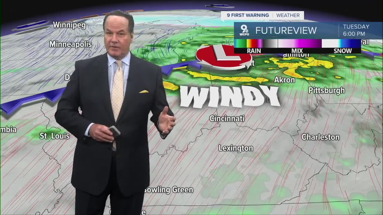


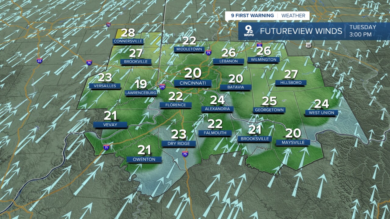
Clouds move back in, and this leads to another warmer night. We'll only cool to 63 degrees. Tuesday morning starts off mild for this time of year, with temperatures in the mid 60s and a mix of clouds around. As we head into the afternoon, highs climb to near 80 degrees, which is well above normal. Plus, winds will be gusty and could reach 40mph. It’ll feel pretty warm and a little humid, with some breaks of sun. Most of the daytime stays dry, but by Tuesday night, lows only fall into the lower 60s as moisture increases, and you may start to see a few scattered showers developing late night.
However, multiple systems will be moving through the Tri-State will bring periodic chances for showers and storms this week.
Thursday keeps the warm trend going, with highs in the upper 70s. The atmosphere stays unsettled, so scattered showers and storms remain possible at times, especially later in the day. Overnight lows stay mild again in the 60s.
Heading into Friday, we stay warm with highs near 80 degrees. There may be some dry stretches, but the overall pattern still supports off-and-on rain chances and a few thunderstorms.

For the weekend, Saturday continues the warm, springlike feel with highs in the upper 70s to around 80. But a cold front will swing through the area triggering rain and possible thunderstorms. Lingering showers may continue into East Sunday morning.

Overall, it’s a classic warm and active spring setup with above-normal temperatures and several opportunities for rain through the weekend.
TONIGHT
Partly cloudy
Warm
Low: 62
TUESDAY
Partly cloudy
Windy
High: 80
TUESDAY NIGHT
Mostly cloudy
Mild
Low: 62
9 First Warning Weather 24/7 Livestream
==========
- Interactive Radar: Track weather to your doorstep
- Sign up for severe weather email alerts
- Check latest school closings and delays
- WCPO traffic updates
- Metro bus detours and updates (or call the hotline at 513-632-7538)
- Latest power outages from Duke Energy
- Flight cancellations and delays from CVG, other U.S. airports
