


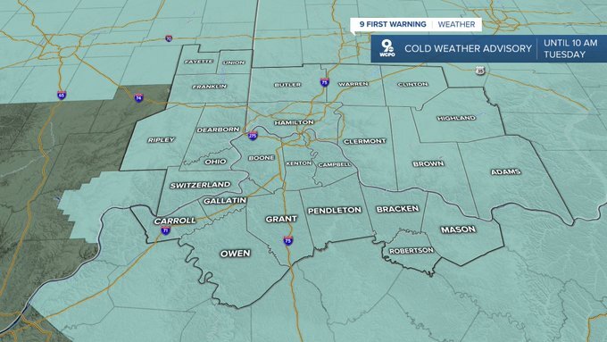
A Cold Weather Advisory remains in effect until Tuesday morning. If you’re heading out, dress in layers and cover up as much skin as you can with hats and gloves to help prevent frostbite.
Due to the dangerous cold, we have issued a Weather Alert Day for Monday night into Tuesday morning. We will drop down into the single digits, pushing the wind chill below zero for the morning commute. Make sure the kids have extra layers heading back to school.
The afternoon will be mostly sunny with mid 20s. With less wind compared to Monday, wind chills should make it into the upper teens in the afternoon.

A warm front arrives Tuesday night, shifting the wind out of the south, and helping to pump in a little more warmth. Highs will be in the low 40s Wednesday, but it will be windy. At least we'll be back to average and back above freezing! Another cold front quickly follows, which could kick off a few pockets of light rain and snow at times Wednesday.
Temperatures start to pull back Thursday. Highs will be in the mid 30s with a mix of sun and clouds.
Friday will be mostly cloudy with low 20s.
Saturday will be frigid with highs only reaching into the teens.
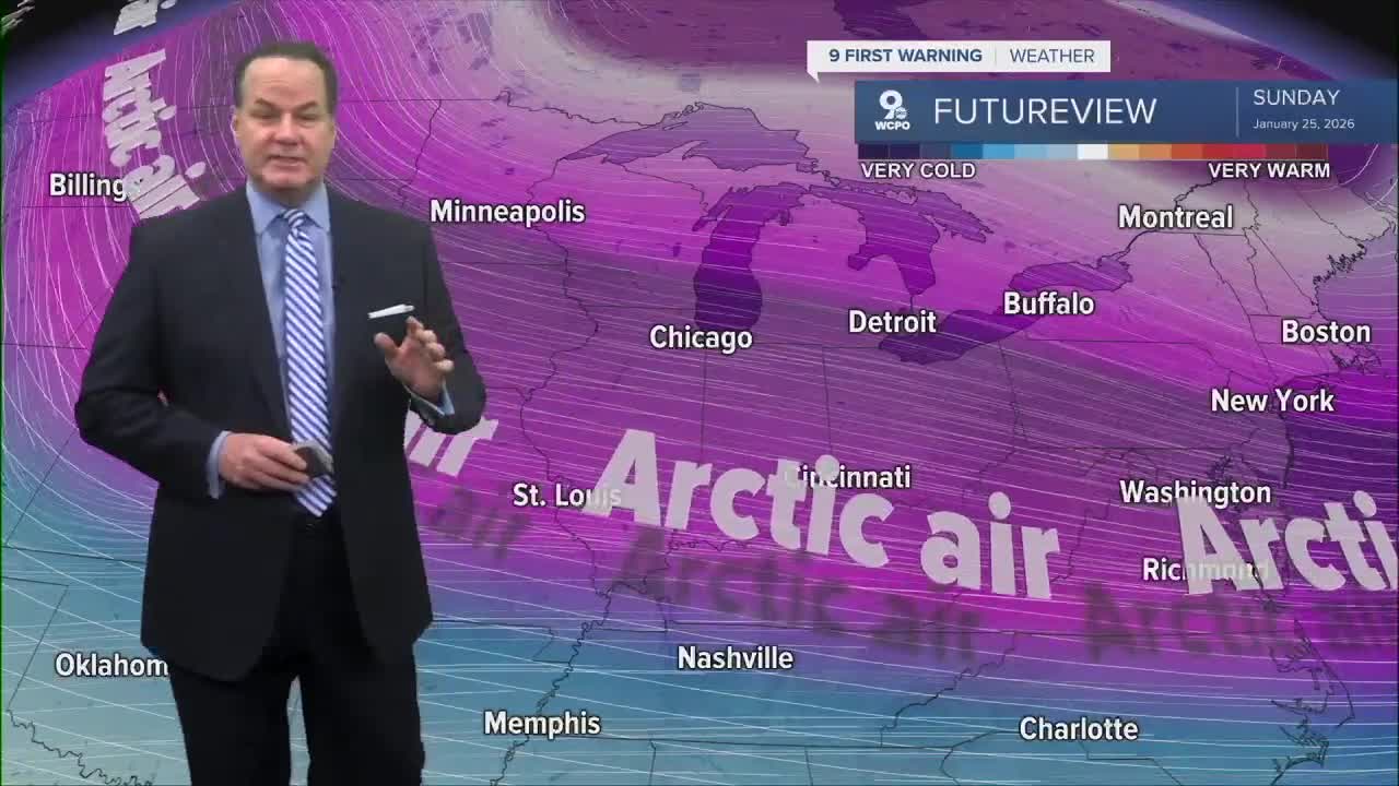
A winter storm will impact the Southeast U.S., which could bring some snow to us late Saturday and into Sunday. If the storm takes a more southerly route, we could even stay dry into the weekend.
After starting Sunday in the single digits, we only reach about 20 degrees in the afternoon.
The stretch of 20s will continue for at least the first half of next week.
TONIGHT
Mostly clear
Frigid
High: 8
TUESDAY
Mostly sunny
Very cold
High: 26
TUESDAY NIGHT
Partly cloudy
Breezy
High: 19
WEDNESDAY
Mostly cloudy
Scattered rain/snow
Windy
High: 41
9 First Warning Weather 24/7 Livestream
==========
- Interactive Radar: Track weather to your doorstep
- Sign up for severe weather email alerts
- Check latest school closings and delays
- WCPO traffic updates
- Metro bus detours and updates (or call the hotline at 513-632-7538)
- Latest power outages from Duke Energy
- Flight cancellations and delays from CVG, other U.S. airports
