

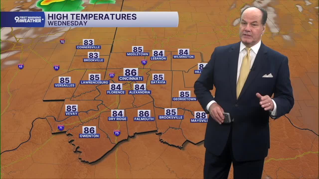


We’re looking at a quiet and comfortable morning across the Cincinnati Tri-State. High pressure remains in control, leaving us with partly cloudy skies, calm winds, and temperatures falling to around 60 by Wednesday morning. That high begins shifting east Wednesday, allowing temperatures to climb compared with the past couple of days. Look for mostly sunny skies with afternoon highs reaching the mid to upper 80s, and winds remaining light. Most of Wednesday stays dry, but our next weather maker will begin approaching from the northwest Wednesday night.
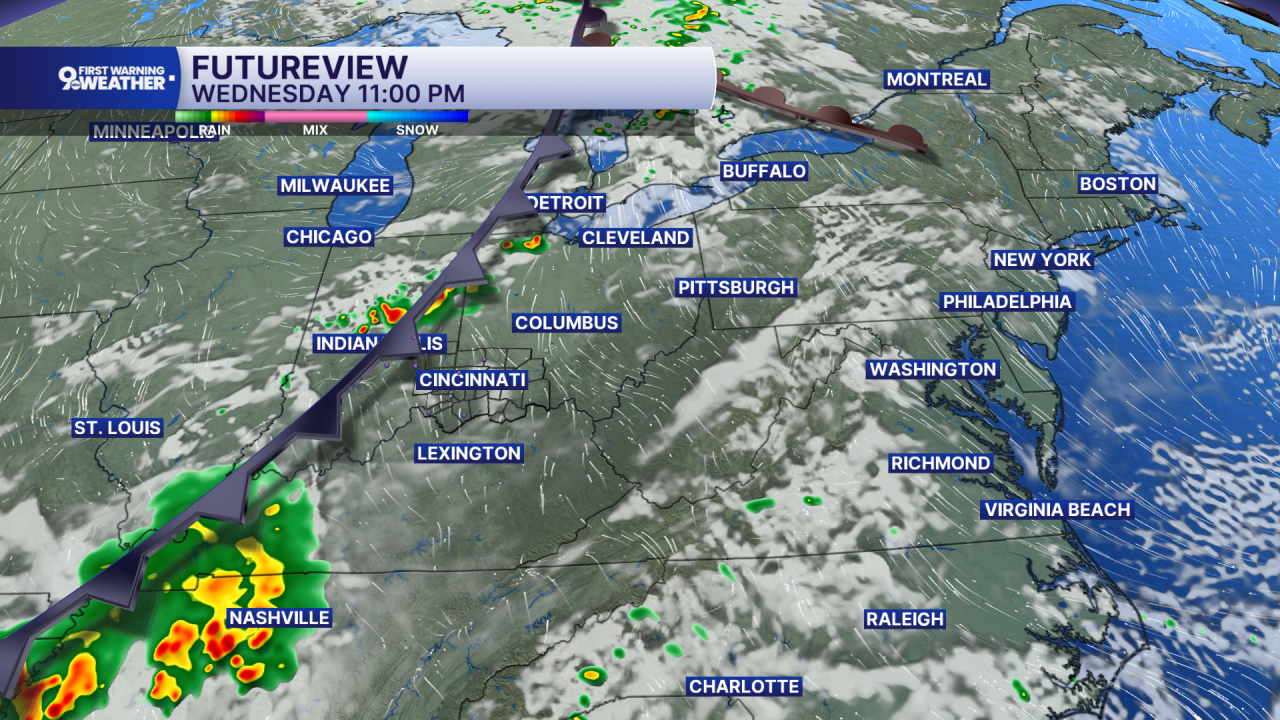
A weak disturbance moving through the Great Lakes will help push a cold front toward the Tri-State. Showers and thunderstorms developing to our northwest may move into the area Wednesday night, although they’re expected to weaken as they arrive. The chance for a few showers increases after 2 a.m., with rainfall amounts generally staying under a tenth of an inch. Temperatures Wednesday night settle into the upper 60s.
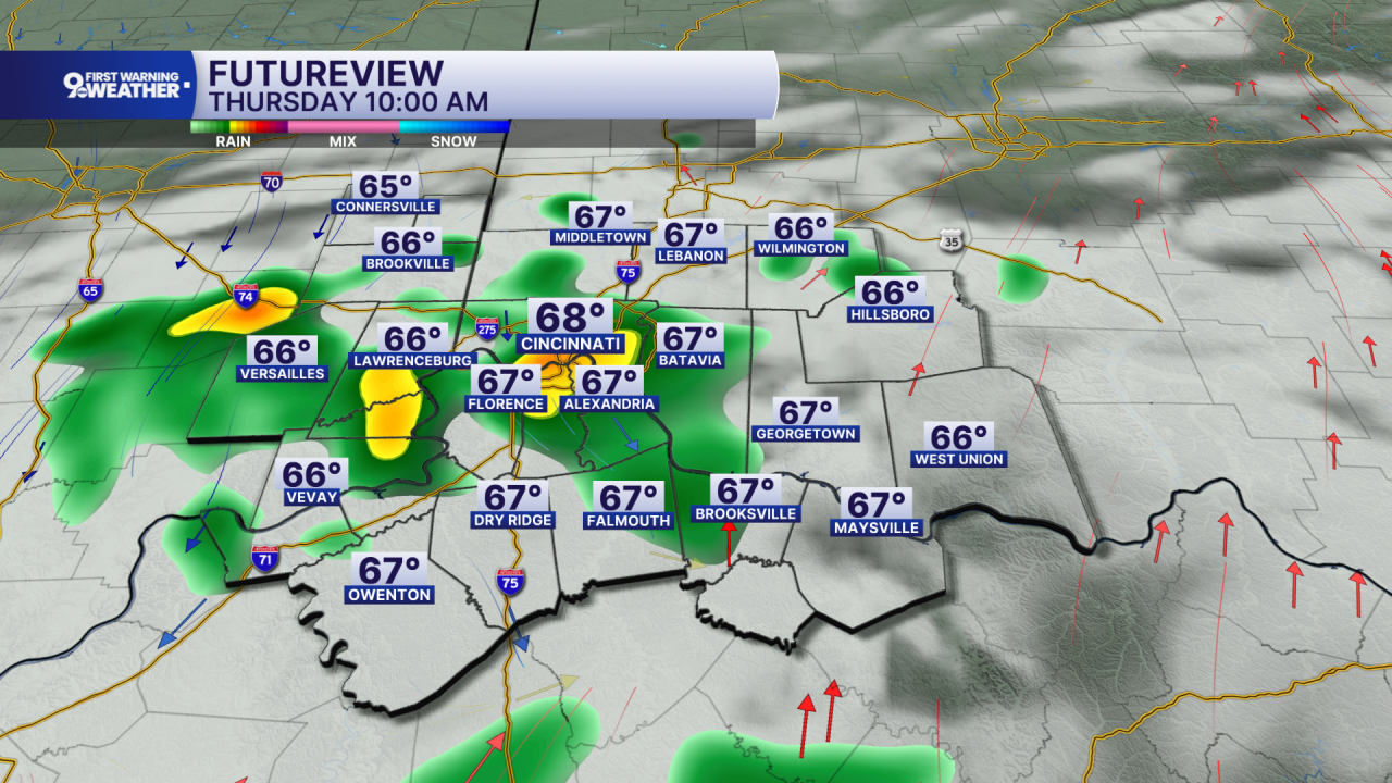
Thursday brings our best opportunity for unsettled weather. There could be a shower early in the morning, followed by another chance for showers and thunderstorms during the afternoon as the front gets closer and the atmosphere becomes more unstable. A few stronger storms may be possible Thursday afternoon into early evening as winds higher in the atmosphere increase somewhat. Most rainfall should be around a tenth to a quarter inch, with locally higher amounts possible in thunderstorms. Highs again reach the mid to upper 80s.
The weather settles down quickly after that. Friday and Saturday are sunny with highs in the mid 80s. Sunshine continues Sunday, but temperatures turn hotter, climbing into the low 90s by afternoon and feeling even hotter!
OVERNIGHT
Mostly clear
Mild
Low: 60
WEDNESDAY
Mostly Sunny
Warmer
High: 86
WEDNESDAY NIGHT
Fair skies
Low: 67
9 First Warning Weather 24/7 Livestream
==========
- Interactive Radar: Track weather to your doorstep
- Sign up for severe weather email alerts
- Check latest school closings and delays
- WCPO traffic updates
- Metro bus detours and updates (or call the hotline at 513-632-7538)
- Latest power outages from Duke Energy
- Flight cancellations and delays from CVG, other U.S. airports
