



Another day of sunshine? Sign us up!
High pressure is sitting over the Ohio Valley today and this ensures we'll see plenty of sunshine throughout the day. We could see some patchy fog first thing this morning from 7-9 a.m. but otherwise the day is clear. Temperatures will warm to 78 degrees and you still won't notice humidity.
The sky is clear again tonight and we'll cool to 57 degrees.
High pressure is shifting to the east on Wednesday and this allows the wind to pick up a bit more from the south. This will lead to warmer temperatures in the mid 80s. You'll also notice more clouds dotting our sky during the day.
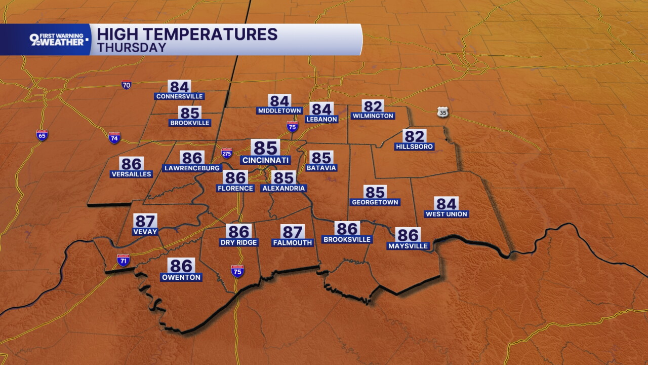
The forecast is still dry on Thursday but a larger area of low pressure is developing to our west. This is going to increase heat and humidity over our area on Thursday. Highs climb to the upper 80s. While dew points rise during the day, you still won't feel too much moisture in the air.
Scattered showers and storms are expected throughout most of our Friday forecast. Temperatures will start to cool due to clouds and rainfall, topping out in the upper 70s.

And cooler air continues to come in behind this system. Highs will settle into the low 70s for this weekend and then into the mid to upper 60s for the first full week of October!
MORNING RUSH
Clear sky
Patchy fog
Low: 53
TUESDAY
Sunshine
A bit warmer
High: 78
TUESDAY NIGHT
Clear sky
Pleasant
Low: 57
WEDNESDAY
Mostly sunny
Warmer again
High: 85
WEDNESDAY NIGHT
Few clouds
Mild
Low: 64
9 First Warning Weather 24/7 Livestream
==========
- Interactive Radar: Track weather to your doorstep
- Sign up for severe weather email alerts
- Check latest school closings and delays
- WCPO traffic updates
- Metro bus detours and updates (or call the hotline at 513-632-7538)
- Latest power outages from Duke Energy
- Flight cancellations and delays from CVG, other U.S. airports
