



What a stretch of weather this has been! We are looking at another day of sunshine, low humidity and mild temperatures.
A cold front passed yesterday and that shifted the wind to the northwest for today's forecast. Temperatures start in the mid 50s and we'll warm to 78 degrees this afternoon. The sky will be sunny and you won't notice humidity once again. All in all, it's another great forecast.

The sky will be clear again tonight and we'll cool to 51 degrees.
Friday's forecast will be sunny, dry and warm. Temperatures are expected to rise to the upper 70s again. As we head into the evening hours for football games or Blink in the downtown area, it's going to be fantastic! By 7 p.m., the temperature should be in the low 70s and cool to 68 degrees by 10 p.m.
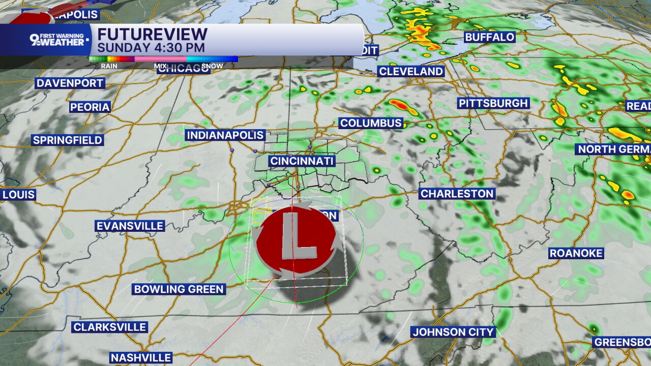
The majority of our Saturday forecast will be dry and it's late in the day that we'll start to see scattered showers returning to the area. The tropical remnants of Hurricane Isaias will come up through the Tennessee Valley during the day Saturday and the most northern bands of rain should enter our area after 8 p.m. So during the day, just expect increasing clouds with highs around 80 degrees.
Rain is likely for Sunday's forecast as the leftover moisture from Isaias sits over the Ohio Valley for the day. This will also bring in cooler temperatures. Highs only climb to 70 on Sunday.
MORNING RUSH
Clear sky
Not as cool
Low: 55
THURSDAY
Sunshine
Mild and dry
High: 78
THURSDAY NIGHT
Clear sky
Cool
Low: 51
FRIDAY
Sunshine
Warm and dry
High: 78
FRIDAY NIGHT
Few clouds
Mild
Low: 57
9 First Warning Weather 24/7 Livestream
==========
- Interactive Radar: Track weather to your doorstep
- Sign up for severe weather email alerts
- Check latest school closings and delays
- WCPO traffic updates
- Metro bus detours and updates (or call the hotline at 513-632-7538)
- Latest power outages from Duke Energy
- Flight cancellations and delays from CVG, other U.S. airports
