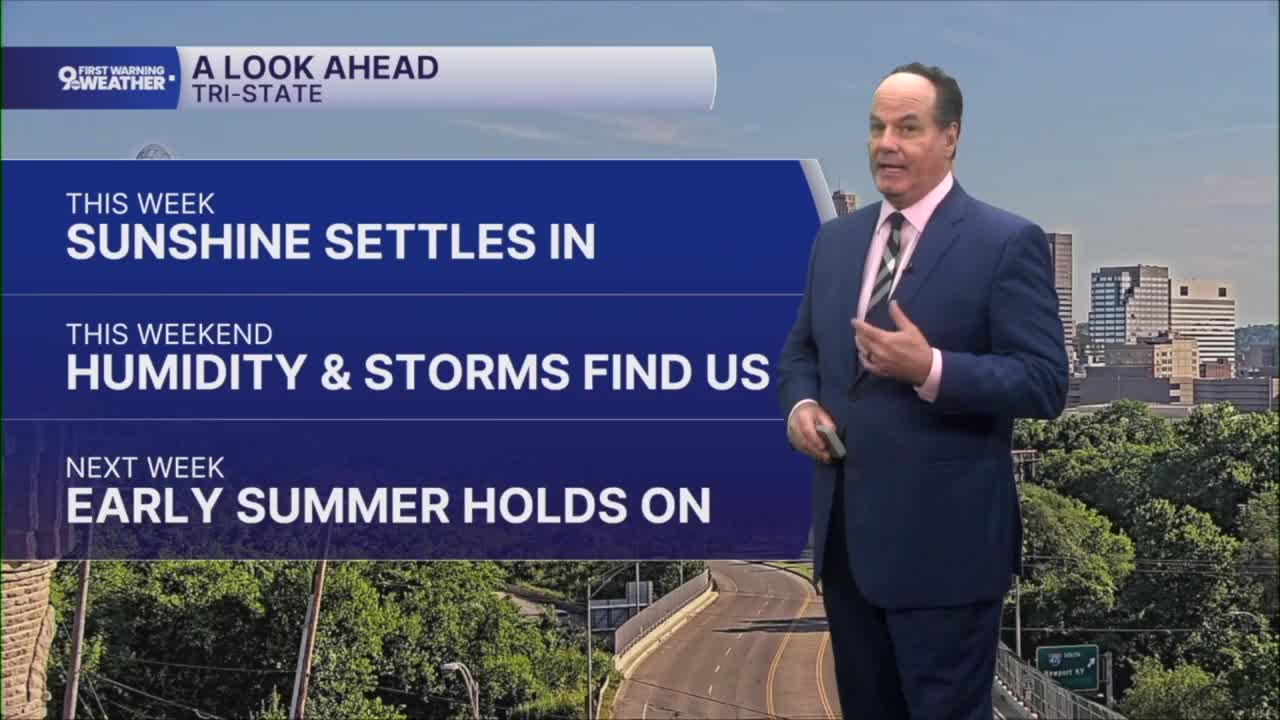


Cincinnati will continue to enjoy a stretch of pleasant early summer weather through the end of the workweek as high pressure settles over the Tri-State. This system will keep skies mostly clear and conditions dry while also allowing winds to remain light. Temperatures will gradually warm from the upper 70s and lower 80s by Thursday.

As the center of the high shifts south and a southwesterly flow develops, warmer and moist air begins moving into the region. By Saturday, the weather pattern begins to change as a trough approaching the Tri-State helps draw even more humid air northward. With dew points climbing into the mid-60s, it’ll begin to get a bit sticky, and the atmosphere will become more favorable for showers and thunderstorms.

The best chance for storms appears from late Saturday afternoon through Saturday night, with some locations potentially staying dry until evening. However, computer models have shifted the timing this week, so check back for updates.

A near-stationary front will then drift through the region, bringing additional opportunities for showers and thunderstorms on Sunday, especially near and south of the Ohio River. While a few storms could linger into Sunday evening. The overall threat of severe weather is low.
Looking ahead to early next week, a strong area of high pressure returns across the Midwest. This bring us a return to mostly sunny skies and mid-summer highs that could reach into the upper 80s.
OVERNIGHT
Clear sky
Mild again
Low: 58
THURSDAY
Mostly sunny
Dry and warmer
High: 82
THURSDAY NIGHT
Mostly clear
Pleasant
Low: 62
9 First Warning Weather 24/7 Livestream
==========
- Interactive Radar: Track weather to your doorstep
- Sign up for severe weather email alerts
- Check latest school closings and delays
- WCPO traffic updates
- Metro bus detours and updates (or call the hotline at 513-632-7538)
- Latest power outages from Duke Energy
- Flight cancellations and delays from CVG, other U.S. airports
