


The clearing continues around the area as we'll head into the weekend with warmer air on Saturday. It's going to mean that the Bengals and FC Cincinnati forecast will be warm.

It'll feel better after the break at TQL.

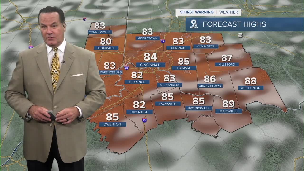
In fact, while it'll be mild in the mid 60s to start, we'll reach the mid to upper 80s in the afternoon. Oh, and it'll be more humid too.

And then Sunday, Canadian air starts to move into the Ohio Valley thanks to a strong Canadian cold front, which will drop the temperatures on Sunday to around 80 degrees. Plus, the humidity drops again before the big changes next week.
We are still on tap for a Fall week with morning lows in the low to mid 50s. We may even see a few communities drop to the upper 40s.
OVERNIGHT
Mostly clear
Warm
Low: 66
SATURDAY
Partly cloudy
Seasonal
High: 85
SATURDAY NIGHT
Partly cloudy
Cooling
Low: 62
SUNDAY
Partly cloudy
Not as humid
High: 80
9 First Warning Weather 24/7 Livestream
==========
- Interactive Radar: Track weather to your doorstep
- Sign up for severe weather email alerts
- Check latest school closings and delays
- WCPO traffic updates
- Metro bus detours and updates (or call the hotline at 513-632-7538)
- Latest power outages from Duke Energy
- Flight cancellations and delays from CVG, other U.S. airports
