


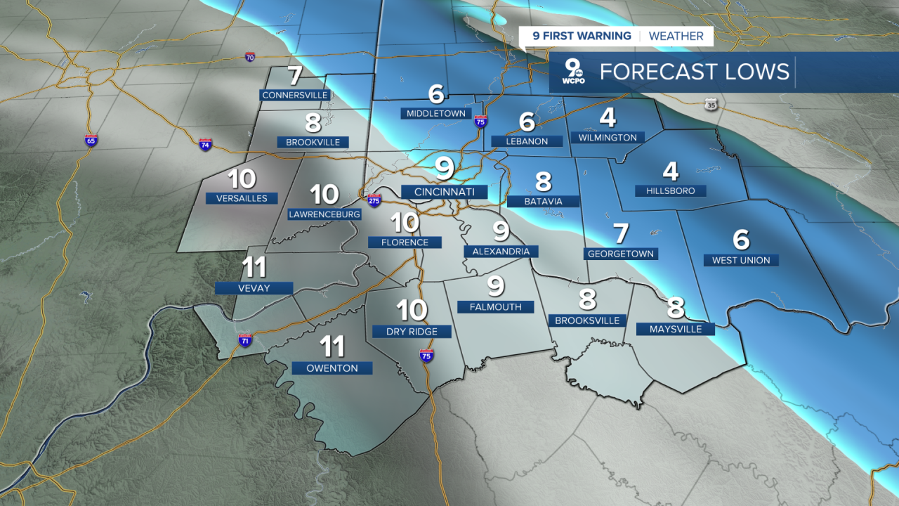
As we roll through the weekend, winter isn’t ready to pack up its parka just yet. For Sunday, frigid air will dominate. In the meantime, temperatures will plunge into the single digits again for Sunday morning, with wind chills nudging even lower. But the story is some light snow for some to start the day.
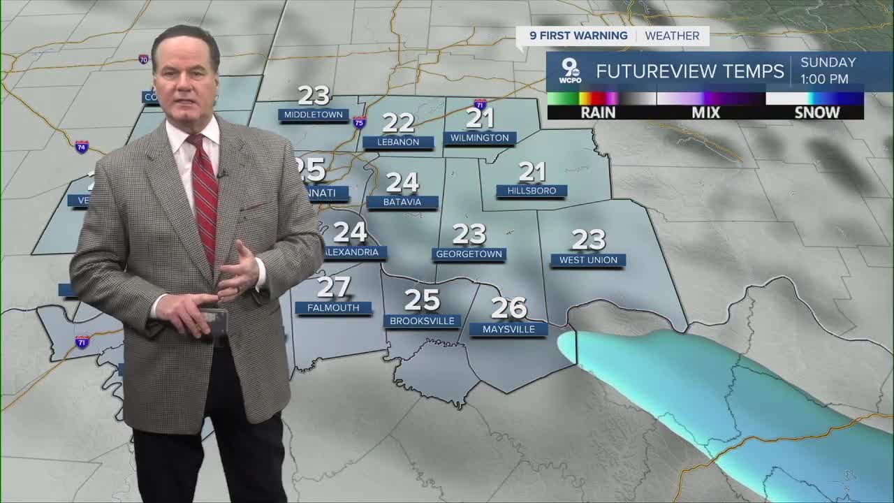
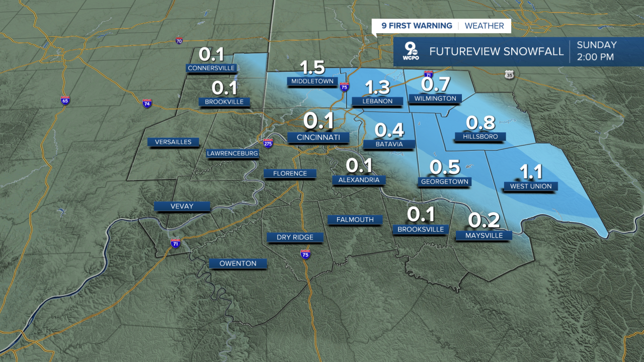
Sunday brings a few flurries or light snow showers in the morning. While the total accumulation won’t be groundbreaking, where the snow flies...roads might get a slick coating of snow or ice, especially on untreated surfaces, so treat your morning with respect. At least half of the Tri-State won't even see any snowflakes. Highs will reach the mid to upper 20s, and clouds will hang around much of the day. With lingering cold and moisture in the air, bundled up is still the best look.
Beyond the weekend, there’s a hint of moderation. Monday should feel mild by comparison, with sunshine mixing with clouds and highs climbing into the upper 30s. By Tuesday, temperatures could flirt with the mid to upper 40s as clouds stick around.
Later in the week, things settle into a chillier pattern again with highs mostly in the 30s and overnight lows dipping below freezing most nights.
OVERNIGHT
Few clouds
Low: 9
SUNDAY
Chance morning snow
Mainly east of Greater Cincinnati
Dusting > 1"
Chilly
High: 28
SUNDAY NIGHT
Stays mostly cloudy
Low: 17
9 First Warning Weather 24/7 Livestream
==========
- Interactive Radar: Track weather to your doorstep
- Sign up for severe weather email alerts
- Check latest school closings and delays
- WCPO traffic updates
- Metro bus detours and updates (or call the hotline at 513-632-7538)
- Latest power outages from Duke Energy
- Flight cancellations and delays from CVG, other U.S. airports
