


It'll continue to be a soggy and chilly night across the Tri-State as rain continues to impact the region. The wet weather is triggered by a low-pressure system moving northeastward, heading for the northeast.
Overcast skies and steady rain will keep temperatures much cooler than normal. While no severe storms are part of this system, expect a few pockets of heavy rain through Thursday.

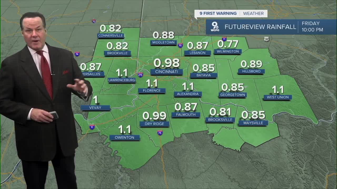
By Thursday afternoon, shower activity should become more scattered, and then we'll dry out by the evening. Rainfall totals could top out around one inch.
The trick or treat forecast is looking much better as the sunshine is back for Friday with highs in the 50s!

At the moment, the weekend is suspect. The computer models are hinting at extra clouds on Saturday and a slight chance for a shower on Sunday. Highs remain in the mid-50s. But with the Bengals & FC Cincinnati playing here and in Columbus, let's hope this changes.
And of course, one other item to consider this weekend.

OVERNIGHT
Rain continues
Cloudy
Low: 45
THURSDAY
Spotty showers
Overcast and cool
High: 50
THURSDAY NIGHT
Clouds start to decrease
Colder
Low: 39
9 First Warning Weather 24/7 Livestream
==========
- Interactive Radar: Track weather to your doorstep
- Sign up for severe weather email alerts
- Check latest school closings and delays
- WCPO traffic updates
- Metro bus detours and updates (or call the hotline at 513-632-7538)
- Latest power outages from Duke Energy
- Flight cancellations and delays from CVG, other U.S. airports
