



While a chance for showers exists overnight, skies will be mostly cloudy, and temperatures will settle into the mid 60s by daybreak.
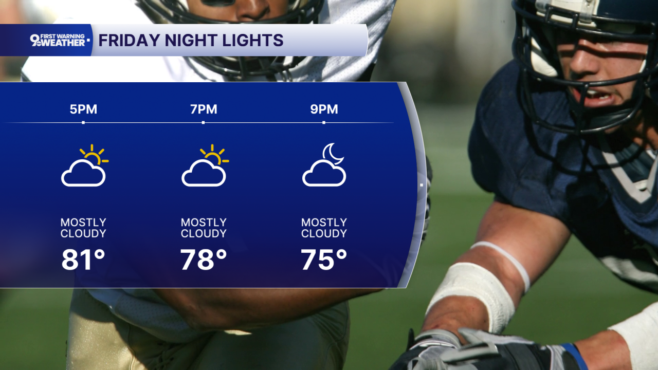
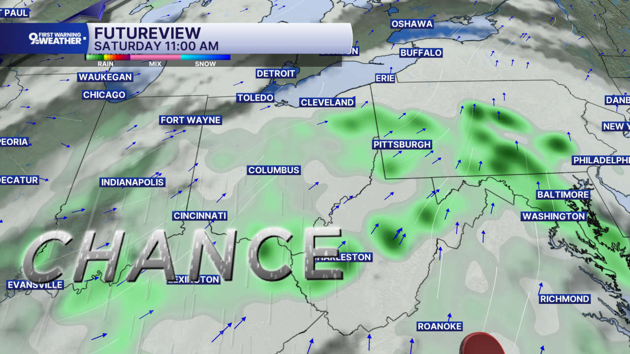
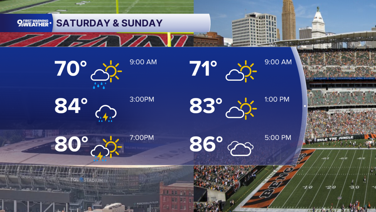
Friday offers a welcome break as that front slips just south of the area, taking the rain with it. Look for partly cloudy skies, light winds, and highs near 80 degrees. The break doesn’t last long, though. Moisture begins returning Friday night as another disturbance approaches, bringing showers back on Saturday. Saturday looks unsettled with periods of showers and possible thunderstorms, especially during the daytime, while temperatures reach the low to mid 80s. Conditions improve Saturday night as the disturbance moves through, setting up a much nicer Sunday.
Expect mostly sunny skies with highs in the mid 80s. From there, the overall trend is warmer. This means the Bengals game looks dry but warm.
You can expect above-normal temperatures as we move into early next week, with sunshine Monday and highs in the mid 80s. Tuesday turns even warmer, reaching near 90, while another chance for showers and thunderstorms enters the picture by midweek.
OVERNIGHT
Mostly cloudy
Chance isolated shower
Low: 66
FRIDAY
Mostly to partly cloudy
High: 80
FRIDAY NIGHT
Partly cloudy
Mild and dry
Low: 65
9 First Warning Weather 24/7 Livestream
==========
- Interactive Radar: Track weather to your doorstep
- Sign up for severe weather email alerts
- Check latest school closings and delays
- WCPO traffic updates
- Metro bus detours and updates (or call the hotline at 513-632-7538)
- Latest power outages from Duke Energy
- Flight cancellations and delays from CVG, other U.S. airports
