


As the cold air and clear skies settle in tonight, it'll make perfect conditions for the temperatures to drop quickly.

We could wake up with a tied or broken record low by 7 am.
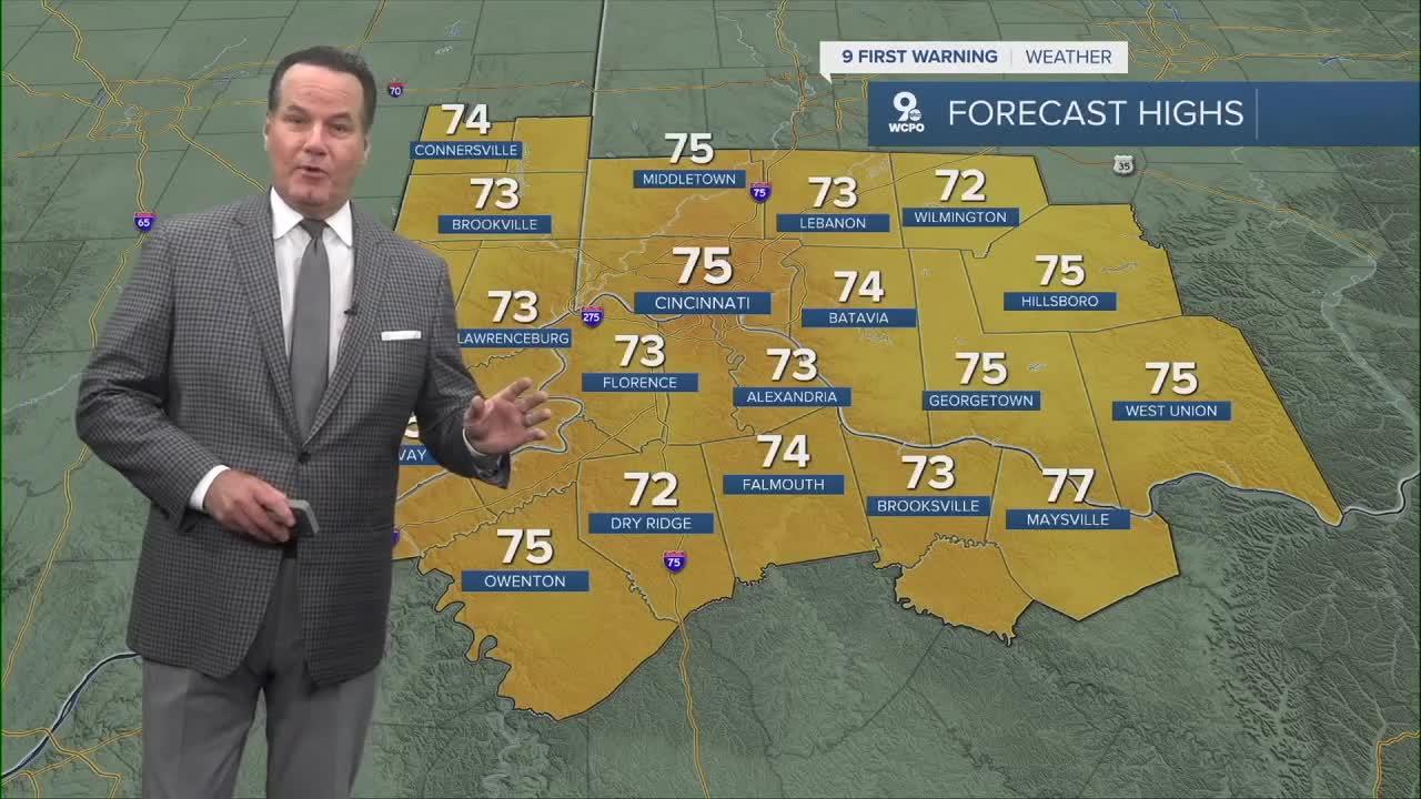
Back in 1946, the morning low was 50°, and that's what I have for Cincinnati in the morning.

Temperatures will remain in the mid to upper 50s and mid to upper 70s right through the weekend, and the conditions will stay dry. Another cold front will reinforce the cool air with a few extra clouds on Thursday.

This means the fireworks forecast looks outstanding!

TONIGHT
Few clouds
Cool
Low: 50
WEDNESDAY
Mostly sunny
Pleasant
High: 75
WEDNESDAY NIGHT
Mostly clear
still cool
Low: 55
9 First Warning Weather 24/7 Livestream
==========
- Interactive Radar: Track weather to your doorstep
- Sign up for severe weather email alerts
- Check latest school closings and delays
- WCPO traffic updates
- Metro bus detours and updates (or call the hotline at 513-632-7538)
- Latest power outages from Duke Energy
- Flight cancellations and delays from CVG, other U.S. airports
