


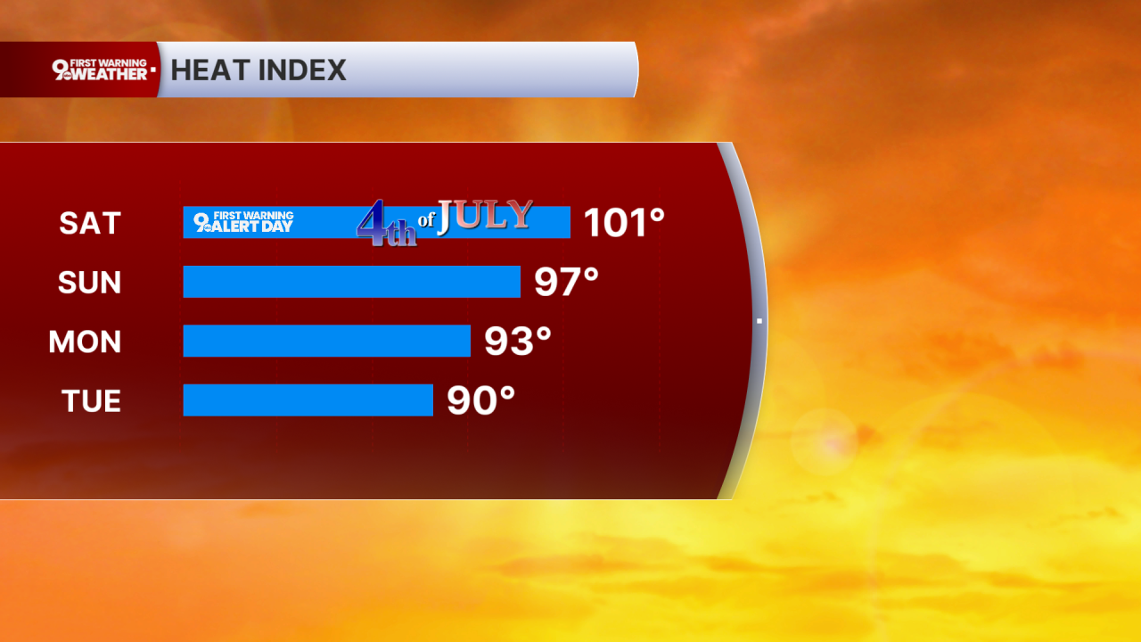
Our 9 First Warning Weather Alert Days continue into Saturday for the 4th of July with more dangerous heat and humidity. Continue to stay cool and hydrated the best you can. It's also a good idea to check on your older neighbors, friends, and family members to make sure they are safe and staying cool.

Our 4th of July starts dry with a lot of sunshine, followed by a mix of sun and clouds in the afternoon. Highs will be in the low 90s, but the humidity will make it feel more like 101 in Cincinnati. The good news is, rain chances have pulled back slightly during the afternoon and evening hours.
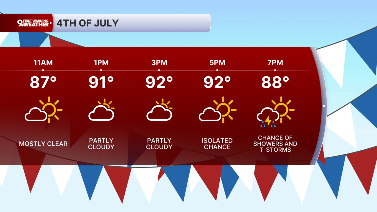
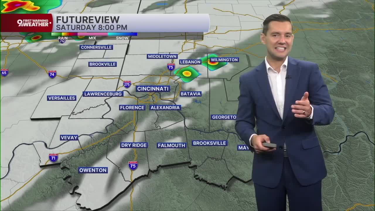
That being said, we are still expecting showers to pop around the 8-midnight timeframe. Which is not ideal for firework shows, but the coverage is looking less than early model runs. Definitely don't cancel your outdoor plans, but keep an eye on radar and be ready to move your plans inside. The storms will come with a small severe threat. Along with the heavy rain and lightning, the strongest storms could also produce strong wind.

We get a touch cooler Sunday. Highs will be in the upper 80s, dropping the heat index down into the upper 90s. Monday will be in the mid 80s, dropping the heat index down into the low 90s. A weak cold front will also stall in the region those two days, kicking off a few scattered showers and storms. Only about a third of the Tri-State will see rain each day.
The mid 80s will continue the rest of the week, keeping temperatures near average for a nice stretch. The humidity won't be as bad as this week, but it will still be muggy.
Scattered showers and storms return Thursday and continue at times into next weekend.
4TH OF JULY
Partly cloudy
Scattered storms
High: 92
TONIGHT
Partly cloudy
Scattered storms
Low: 73
SUNDAY
Partly cloudy
Spotty storms
High: 89
9 First Warning Weather 24/7 Livestream
==========
- Interactive Radar: Track weather to your doorstep
- Sign up for severe weather email alerts
- Check latest school closings and delays
- WCPO traffic updates
- Metro bus detours and updates (or call the hotline at 513-632-7538)
- Latest power outages from Duke Energy
- Flight cancellations and delays from CVG, other U.S. airports
