
This weekend, Tropical Storm Barry will make headlines as winds around 70 mph impact southern Louisiana along with the storm surge and heavy rainfall produced by this slow moving tropical system. Here's a look at the latest update from the National Hurricane Center.

5 A.M. UPDATE FROM NHC
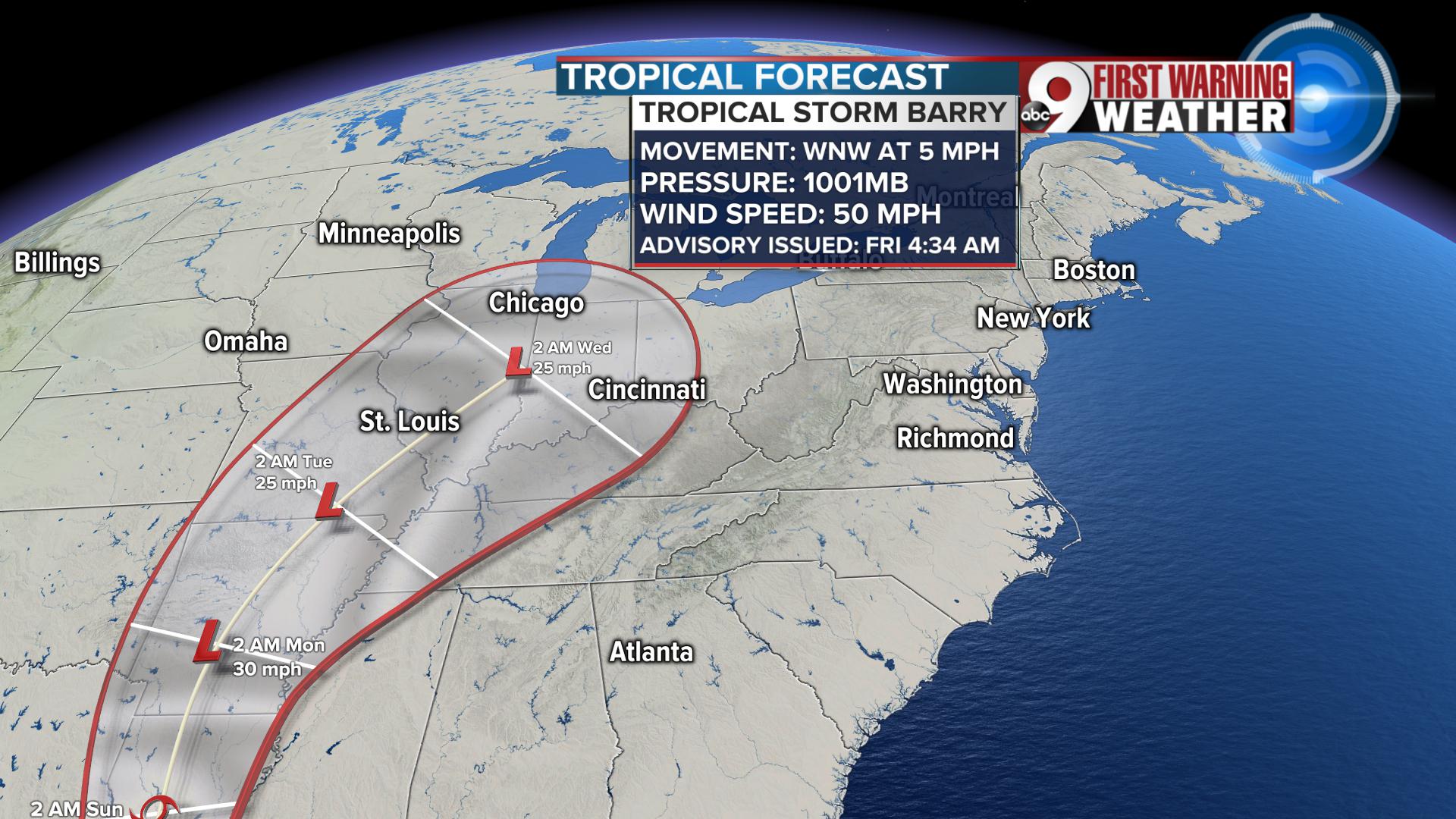
As this system weakens and heads north, it will continue to produce rainfall. By Tuesday, a turn to the northeast will bring this precipitation into the Ohio Valley.
It feels odd to say "we need rain" after the excessive amount of moisture that has come down in 2019, but we could use some fresh rainfall. As of July 12, we have picked up 35.63 inches of rain this year. That is 11.69 inches above normal.
Looking at the recent forecasts though, there is very little rain to talk about. For the first 11 days of July, we've only recorded 0.02 inches of rain in Cincinnati.
You have to go back at least 17 days to find a forecast where we picked up a soaking shower in Cincinnati. The last heavy rain was on June 24 with 0.62 inches of precipitation.
Often times in July and August, relief from heat and the return of rain comes from tropical remnants. Here's the good news if you want to green up your lawn without turning on the sprinklers, the remnants of Barry should move into the Ohio Valley next week.
Here is the path map from the National Hurricane Center that shows where Barry is headed by Monday, Tuesday and Wednesday. As you can see, the northeast turn could push leftover scattered showers and storms into the Ohio Valley. This is still a system that could adjust and change, so know that we are watching it and will let you know about the best rain chances in the days ahead.
Longer term path of Barry
