
It's undeniable that the Halloween forecast is one of high interest this week, especially with the difficult forecast unfolding. Here's a look at what we are expecting for Thursday evening.
RAIN
The highest chances for rain will be Thursday morning and into the early afternoon. The cold front is slated to pass through the Ohio Valley between noon and 4 p.m., and this will give us a more likely push of showers, potentially a few thunderstorms.

Cold front by 1 p.m.
The good news is, it looks like rain will be tapering off and exiting to the east by 6 p.m. It's very likely that our southeast Indiana counties will be dry for trick-or-treat hours. Where we cannot rule out rain completely at 6-8 p.m. is Adams, Mason, Highland and Brown County.

Rain by 6 p.m.
WIND
We aren't just talking about a little, occasional breeze. We should see winds sustained at the 20-25 mph range throughout the afternoon. Winds will then begin to gust up to 40 mph after the cold front passes.
Since this lines up with trick-or-treat hours, you may want to be mindful of larger costumes that might get blown around, flattened or torn apart by the wind. Especially consider this if your child is wearing an inflatable costume.
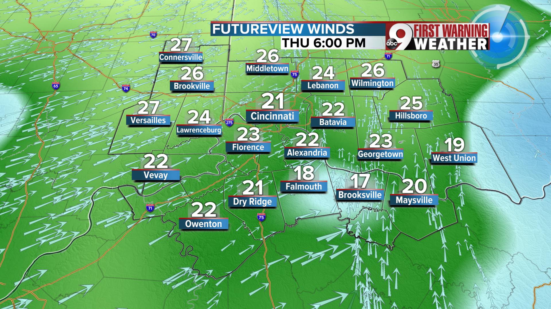
Sustained surface winds
TEMPERATURES
You'll notice that our app says the high on Thursday is 63. That high comes in at 9 a.m., and we will then cool from there. The temperature is one of the elements we may still need to tweak a bit in the forecast but the message is clear, it will cool down fast.
Currently, it looks like temperatures will be mid to upper 40s by 6 p.m. and cooling to the mid to upper 30s by 9 p.m.

Temperatures tumble
