


We are counting down the days to Christmas as we tally up how much warmer it will get with each passing day. To say we are in for a unique Christmas Day forecast might be an understatement.
Mostly cloudy skies for this tonight with temperatures in the 40s. Expect winds 10-20 mph for your Friday.
Christmas Eve is looking like a beautiful day! We'll warm to 57. Just like today, a breezy south wind is expected at 10 to 20 mph, gusting to 25 mph. The sky will be mostly cloudy to overcast.
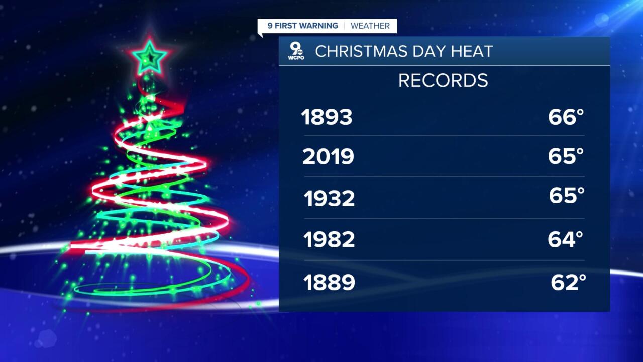
And then we roll into Christmas Day with near record-breaking temperatures. The morning starts at 52 and ends with a high of 63 degrees. The record for Christmas Day is 66 and I wouldn't rule out getting up to that temperature. As for rain chances, we could still see spotty, light rain during the day, even drizzle at times. The sky will be overcast all day, too.
FRIDAY MORNING
Mostly cloudy
Milder
Low: 42
CHRISTMAS EVE
Mostly cloudy to overcast
Warm and windy again
High: 57
FRIDAY NIGHT
Overcast
Dry
Low: 52
CHRISTMAS DAY
Mostly cloudy
Isolated showers
High: 63
==========
