


A record-breaking polar vortex collapse and the strongest El Niño in years are both heading for the U.S. — and forecasters say only one can win.
You've probably heard that El Niño means a mild winter. That's usually true — but this year, something scientists have never seen before is threatening to flip the forecast. The polar vortex broke down earlier than ever recorded, and bitterly cold Arctic air is already spilling south.
Find out what this clash of weather systems actually means for where you live — and whether El Niño or the polar vortex is likely to have the last word.
- 7–14° — Below average
- 2.5°C — Above normal
Here's the collision that forecasters are wrestling with: on one side, the strongest El Niño in years is pushing warmer-than-normal Pacific water to the surface, with sea temperatures already 2.5 degrees Celsius above normal in the region where El Niño develops. That's the kind of reading that historically guarantees a mild winter for most of the U.S.
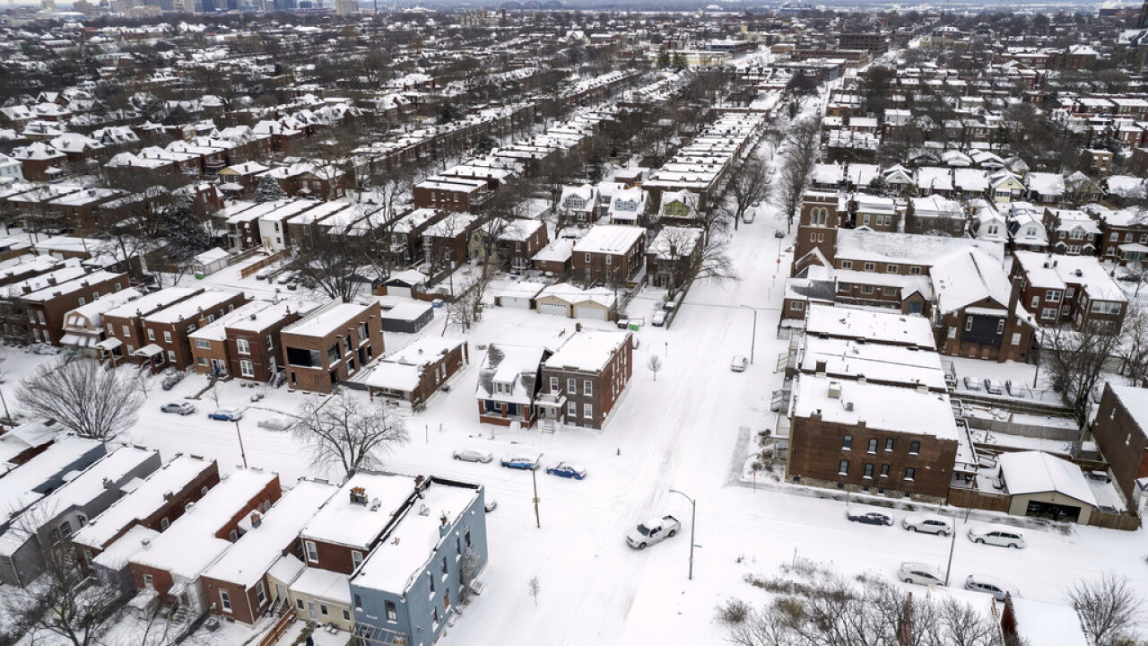
On the other side, the polar vortex — the spinning system of winds that normally traps Arctic air near the North Pole — has collapsed earlier than scientists have ever recorded. When it breaks down, cold air doesn't stay put. It spills south. Parts of the eastern U.S. are already seeing temperatures 7 to 14 degrees below average as a result.
El Niño vs. Polar Vortex: What Each System Does
| El Niño | Polar Vortex Collapse | |
|---|---|---|
| Origin | Warmer-than-average water in the equatorial Pacific Ocean | Breakdown of winds normally locking Arctic air near the North Pole |
| Typical winter effect | Milder temperatures across much of the U.S. | Frigid Arctic air spills south into the U.S. |
| Impact on South / Gulf Coast | Wetter conditions historically | Cold air can push further south than usual |
| Impact on North | Drier weather typically | Heaviest cold air intrusions historically |
| Atlantic hurricane effect | Strengthens upper-level winds, suppresses hurricane formation | Limited direct effect on Atlantic storms |
| 2023–24 outlook | Strong signal — sea temps 2.5°C above normal | Record early collapse — timing is unprecedented |
What makes this winter so difficult to forecast is that both systems are unusually strong at the same time — and they tend to push conditions in opposite directions. Forecasters are frank about the uncertainty: it's too early to know which weather pattern will dominate.
What scientists can say is that the polar vortex is not a storm. It's a regular feature of Earth's polar latitudes — a concentration of cold air and low pressure that normally stays close to the poles. When the vortex is stable and spinning fast, it acts like a fence keeping Arctic air away from populated regions. When it weakens or breaks down, that fence disappears.
How Well Do You Know These Winter Weather Systems?
Four questions. The answers might surprise you.
When the polar vortex 'breaks down,' what actually happens?
- A massive blizzard forms over the Arctic — No storm forms — the vortex isn't a storm. When it breaks down, the system of winds that keeps Arctic air near the North Pole weakens, allowing frigid air to spill south toward populated regions.
- The spinning winds that trap Arctic air near the poles weaken — Exactly right. The polar vortex is a concentration of cold air and low pressure. When its winds weaken, Arctic air is no longer contained near the poles and can flood southward into the U.S.
- Arctic temperatures drop to record lows at the North Pole — It's the opposite — the cold air doesn't stay at the pole. When the vortex breaks down, it's the regions to the south that bear the brunt as frigid air escapes its usual boundaries.
- El Niño automatically strengthens to compensate — These are two separate systems. El Niño is driven by Pacific Ocean water temperatures, not polar wind patterns — and right now, forecasters aren't sure which one will dominate this winter.
El Niño is best described as a disruption to which system?
- Arctic wind circulation near the North Pole — That's the polar vortex. El Niño is an ocean-driven phenomenon, not an Arctic wind event — the two are distinct systems that happen to be colliding in an unusually dramatic way this year.
- A climate cycle in which equatorial Pacific water warms above average — Correct. El Niño is part of a climate cycle in which waters in the equatorial Pacific Ocean become warmer than average. This year, sea surface temperatures in that region are expected to be 2.5 degrees Celsius above normal.
- Atlantic hurricane formation patterns — El Niño does affect Atlantic hurricanes — by strengthening upper-level winds that make it harder for them to form — but that's an effect of El Niño, not what El Niño itself is.
- Seasonal rainfall patterns in the North only — El Niño actually brings drier weather to the North and wetter conditions to the southern U.S. — the opposite of what many people expect, and a key reason its effects vary so much by region.
Historically, what does El Niño do to Atlantic hurricane activity?
- It amplifies hurricane seasons by warming Atlantic waters — It's actually the reverse. El Niño strengthens upper-level winds in the Atlantic — and those stronger winds create wind shear that makes it harder for hurricanes to form and intensify.
- It has no measurable effect on hurricane formation — El Niño has a well-documented effect on Atlantic hurricanes. It strengthens upper-level winds in the Atlantic, which suppresses hurricane development — one of the few weather benefits linked to El Niño.
- It strengthens upper-level Atlantic winds, suppressing hurricane formation — Correct. El Niño is known for strengthening upper-level winds in the Atlantic, making it harder for hurricanes to form — a notable silver lining in an otherwise complicated forecast for this season.
- It shifts the hurricane season later into December and January — El Niño suppresses hurricane activity overall rather than shifting its timing. The key mechanism is increased wind shear over the Atlantic, which disrupts the conditions storms need to organize and strengthen.
What makes this year's polar vortex disruption historically unusual?
- It formed over the Atlantic instead of the Arctic — The polar vortex always forms at Earth's polar latitudes — it's a permanent feature of the Arctic. What's unprecedented this year is not where it formed but when it broke down.
- It collapsed earlier in the season than ever previously recorded — That's the key finding. Scientists say the system of winds that usually keeps Arctic air near the North Pole has broken down earlier than ever recorded — meaning this winter's cold air threat arrived before the season even fully began.
- It merged with El Niño to create a hybrid system — The polar vortex and El Niño are separate systems operating independently — they're colliding in terms of their competing effects on U.S. weather, but they haven't merged into a single phenomenon.
- It weakened the Pacific Ocean's surface temperatures — Pacific sea surface temperatures are driven by El Niño, not the polar vortex. Those temperatures are already 2.5 degrees Celsius above normal — a signal of El Niño's strength, not a consequence of the vortex disruption.
Your Region's Winter Outlook
Forecasters say it is too early to know which weather pattern will ultimately dominate this winter — both the polar vortex collapse and El Niño signals are unusually strong.
The uncertainty cuts both ways. If El Niño wins the tug-of-war, much of the country gets the mild, slightly wetter winter that historical patterns predict. If the polar vortex disruption dominates, some regions face cold snaps far more severe than the El Niño forecast suggested. And it's possible — even likely — that both play out in different parts of the country at different times.
What is not in doubt is El Niño's strength this season. Sea surface temperatures in the equatorial Pacific are already 2.5 degrees Celsius above normal, well into the range that climate scientists consider historically significant. A previous Scripps News investigation found that a super-sized El Niño could be linked to more than 450,000 heat-related deaths globally by February.
El Niño's Historical Regional Effects on U.S. Winter Weather
What's True About This Winter's Forecast
El Niño guarantees a mild winter across the entire United States.
Verdict: mostly false
El Niño tends to produce milder winters across much of the country — but this year's unprecedented early polar vortex collapse has already pushed temperatures 7 to 14 degrees below average in parts of the eastern U.S., and forecasters say it's too early to know which system will dominate.
The polar vortex is a storm that moves across the country.
Verdict: false
The polar vortex is not a storm. It is a permanent concentration of cold air and low pressure at Earth's polar latitudes. When its winds weaken or break down, it allows Arctic air to spill south — but the vortex itself does not travel.
El Niño typically makes hurricane seasons worse.
Verdict: false
The opposite is historically true. El Niño strengthens upper-level winds in the Atlantic, making it harder for hurricanes to form — one of the few beneficial weather effects associated with a strong El Niño event.
This year's polar vortex breakdown is unprecedented in its timing.
Verdict: true
Scientists say the system of winds that usually keeps Arctic air near the North Pole has broken down earlier than ever recorded — a fact that makes this winter's forecast more uncertain than a typical El Niño year.
The Science Behind the Polar Vortex
The polar vortex is a regular feature of Earth's polar latitudes. It is a concentration of cold air and low pressure that is usually kept relatively close to the north and south poles by a band of fast-moving winds.
When those winds are strong and stable, they act as a barrier — keeping the Arctic air locked in place and away from more populated latitudes. When they weaken or break down, the cold air is no longer contained. It spreads southward, sometimes dramatically, sending temperatures plunging in regions that may have expected a mild stretch.
Scientists note that the vortex has broken down earlier this season than any previously documented case — a signal that is especially striking given how strong the competing El Niño signal is at the same time.
What Is El Niño — And Why Is This One So Strong?
El Niño is part of a recurring climate cycle in which waters in the equatorial Pacific Ocean become warmer than average. This warming shifts weather patterns across the entire globe, with effects that ripple through rainfall, drought, storm activity, and winter temperatures.
This season's El Niño is shaping up to be historically powerful. Sea surface temperatures in the region where El Niño develops are expected to be 2.5 degrees Celsius above normal — a reading that places this event among the strongest on record.
Historically, El Niño brings wetter conditions to the southern United States and drier weather to the North. It also tends to produce milder winters across much of the country. But it has a lesser-known effect too: strengthening upper-level winds in the Atlantic, which suppresses hurricane formation.
How to Stay Ahead of an Unpredictable Winter
- Watch for polar vortex alerts, not just storm warnings — The polar vortex doesn't announce itself like a blizzard. Monitor your local forecast for rapid temperature drops of 10 degrees or more over 24 hours — a sign that Arctic air has broken through.
- Don't assume El Niño means warmth for your zip code — El Niño's warming effect varies significantly by region. The southern U.S. gets wetter, the North gets drier, and the coasts experience something different still. Know your region's historical pattern.
- Prepare for temperature swings, not just one type of winter — When two powerful weather systems compete, the result is often volatility — mild stretches interrupted by sudden cold snaps. Prepare your home and your plans for both extremes.
- Follow forecasters through mid-winter — Forecasters say it's too early to know which pattern will dominate. Check updated seasonal outlooks from your local weather service as the season progresses — the picture should clarify by late December.
The clash between El Niño and the polar vortex is a reminder that winter weather is rarely a single story. It's a competition between planetary-scale systems, each operating on its own logic, each capable of overriding the other. For America's communities, that means preparation matters more than prediction this year.
What forecasters are certain of: both systems are unusually strong. The uncertainty isn't about whether these forces are real — it's about which one blinks first.
