


Happy New Year! It has been a warm and gloomy first day of 2023 and that will likely be the case for the next three days of the year as well.
Lingering mist or fog has been with us through the day and it will likely stick around through the overnight, but that really shouldn’t do much other than create a dreary feel for most.
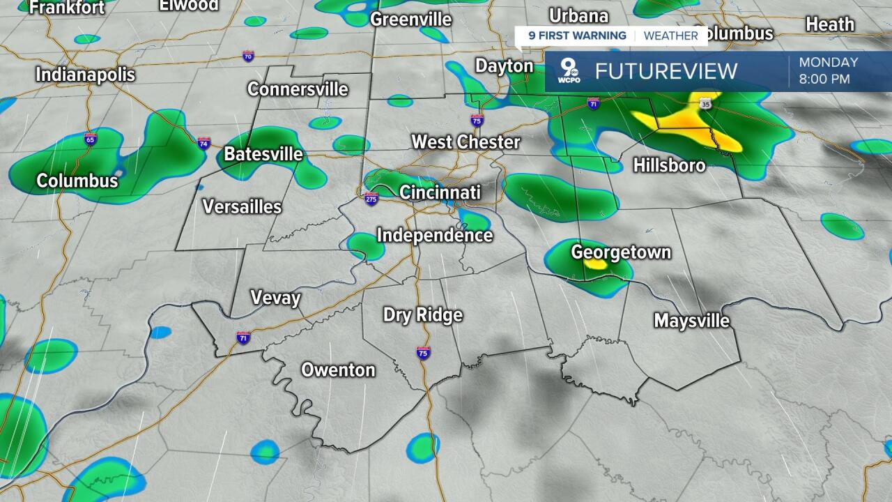
Moving into the overnight tonight and early on Monday we will hold onto the cloud and the warmth, but we may also see a few scattered light showers. Nothing more than a sprinkle or nuisance shower, but it will keep that gloomy feeling for sure. Temperatures only fall into the upper 40s and low 50s for most, dropping towards 48 degrees.
As we kick the first Monday of 2023 off it will feel more like late March than early January. Expect temperatures to be back in the mid to upper 50s through the afternoon with the clouds still around as well. Humidity will climb with the south wind of 5 to 10 mph and we will have some unorganized stray showers at times. While most of us will be dry during the day, some light showers will try to sneak in for the evening. These showers will be more likely as we get closer to midnight, but we may still have a few that pop up during the big game at Paycor between the Bengals and the Bills. Kickoff is at 8:30 p.m. and you can find the game right here on WCPO. Temperatures will be at their warmest on Monday during the late evening, possibly reaching 60°.
Overnight Monday into Tuesday is the main weather event of the week, with showers and storms rolling in after midnight into early Tuesday morning. These storms shouldn’t be severe, but they may bring some gusty winds and some very heavy downpours to parts of the Tri-State. Rainfall will be heaviest during the morning hours on Tuesday as the main line comes through. Rainfall could be heavy enough to lead to flooding in some locations, so make sure you’re staying alert Tuesday morning. Rainfall for some communities could be close to 2 inches.
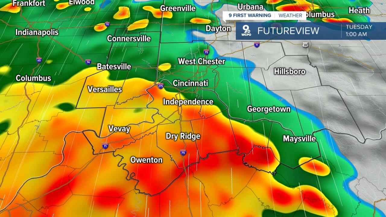
Along with the clouds and rain, temperatures will be very warm, making the mid-60s. This could potentially be record breaking. Our record high temperature for January 3 in Cincinnati is 64° set in 1950. That is the current forecast as well. While we battle rain and storms on Tuesday, we will also have some strong winds that are not thunderstorm related. Steady strong south winds of 15 to 20 mph are likely through the morning, with gusts as strong as 30 to 35 mph.
Strong winds and heavy rain are expected for parts of the Tri-State on Tuesday! Non-thunderstorm gusts of 40 mph will be possible! @WCPO #WCPO #OHwx #CincyWX #INwx #NKYwx pic.twitter.com/4wOPVsWM0P
— Brandon Spinner WCPO (@wxSpinner89) January 1, 2023
Wrap around rain will be possible early on Wednesday with temperatures in the mid-50s before falling through the rest of the week. Normal-ish temperatures return Thursday with a few snow flurries or sleet possible too!
SUNDAY NIGHT
A few showers
Staying cloudy and mild
Low: 48
MONDAY
Mostly cloudy, isolated showers
Staying warm, rain late
High: 60
MONDAY NIGHT
Showers and storms moving in
Gusty winds
Low: 58
TUESDAY
Showers and storms, breezy winds
Record warmth possible too
High: 64
9 First Warning Weather 24/7 Livestream
==========
- Interactive Radar: Track weather to your doorstep
- Sign up for severe weather email alerts
- Check latest school closings and delays
- WCPO traffic updates
- Metro bus detours and updates (or call the hotline at 513-632-7538)
- Latest power outages from Duke Energy
- Flight cancellations and delays from CVG, other U.S. airports
