

Several severe thunderstorm warnings have been issued for many counties in the Tri-State earlier today. We've already had several wind damage reports from across the area. Most of the reports have been downed trees, including some on houses and cars.
Lows only dip to the mid 70s tonight as it stays very muggy.
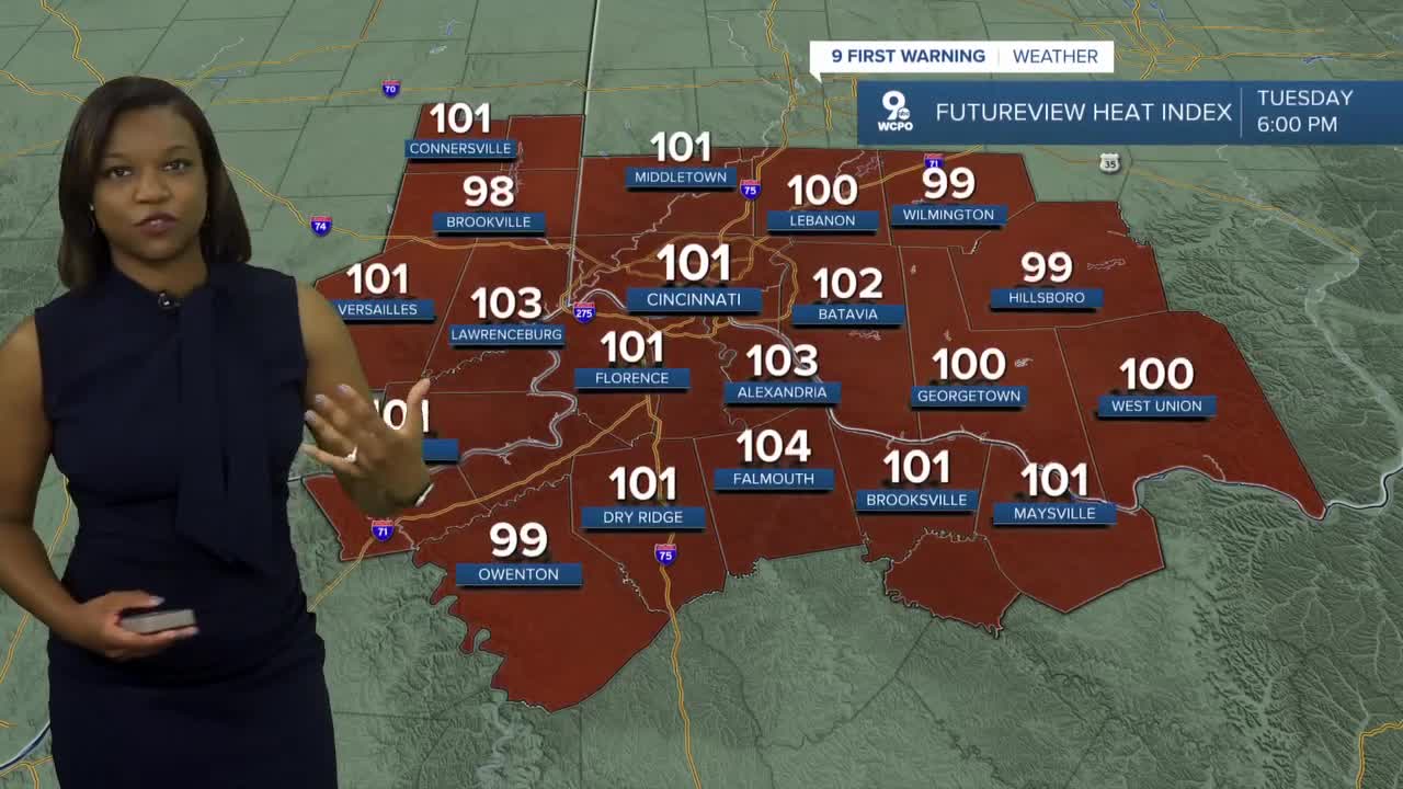
TUESDAY WILL BE A 9 FIRST WARNING WEATHER ALERT DAY due to the heat and humidity.
Then comes the heat and let's be honest, we haven't dealt with heat yet in 2022. The warmest day so far this year was 89 degrees on June first. We'll see a 90+ degree stretch for several days. But it's the oppressive humidity that will make it that much worse. We are looking at heat index values between 100-110 in the coming days. The NWS has issued an EXCESSIVE HEAT WARNING for all of the Tri-State for Tuesday.

Here's a look at the stretch of heat and record highs for the week. It is possible that we could tie or break some heat records this week.

TUESDAY MORNING
Muggy start
Mostly cloudy
Low: 74
TUESDAY
Hot and humid
Heat index between 105-110
High: 96
TUESDAY NIGHT
Very muggy
Few clouds
Low: 76
WEDNESDAY
Partly cloudy
Hot again!
High: 96
9 First Warning Weather 24/7 Livestream
==========
- Interactive Radar: Track weather to your doorstep
- Sign up for severe weather email alerts
- Check latest school closings and delays
- WCPO traffic updates
- Metro bus detours and updates (or call the hotline at 513-632-7538)
- Latest power outages from Duke Energy
- Flight cancellations and delays from CVG, other U.S. airports
